Area Overview for CR2 6HZ
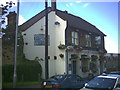
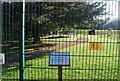
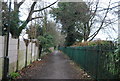
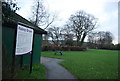
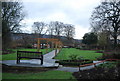
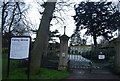
Photos of CR2 6HZ
Area Information
Living in CR2 6HZ offers a settled residential experience within a compact community spanning just 1.3 hectares. This specific postcode cluster forms part of the wider South Croydon ward in the London Borough of Croydon, located on the southern edge of London near the historic counties of Surrey. The area supports a population of 1,721 residents, creating an intimate neighbourhood feel compared to the broader district. Historically, this part of South Croydon developed in the 19th century from land within the ancient manors of Croham and Haling. It retains a distinct suburban character, situated approximately 51.357607, -0.065714, though this location serves as a gateway to the historic heart of South Croydon rather than the immediate site itself. Nearby landmarks include Croham Hurst, a 34-hectare woodland acquired as public open space in 1901, and the historic Croham Manor Road conservation area. The community benefits from proximity to the Whitgift School and the Whitgift Foundation site, adding cultural depth to the local environment. For those interested in the heritage of the region, the area lies close to sites connected to David Lean and the historic South Croydon bus garage. Daily life here is defined by its small scale, making it an attractive option for those seeking a quiet domestic setting while remaining within practical reach of central Croydon's main services.
- Area Type
- Postcode
- Area Size
- 1.3 hectares
- Population
- 1721
- Population Density
- 8857 people/km²
Homes in CR2 6HZ are predominantly owner-occupied properties, with 60% of the area held by owners rather than landlords. The accommodation type is exclusively houses, which shapes the market significantly for prospective buyers. This indicates a stock made up of detached, semi-detached, or terraced family homes rather than flats or purpose-built rental blocks. The small size of the area, covering just 1.3 hectares, limits the sheer volume of listings but ensures a cohesive neighbourhood aesthetic. Living in this postcode means purchasing a home where the majority of neighbours are homeowners, often leading to stronger community governance and higher rates of maintenance. The high ownership percentage suggests that the local estate is composed of families who have stayed over periods, making property values potentially stable and resilient to rapid fluctuations. For buyers looking at this cluster, the market reflects a traditional suburban model where character homes dominate over modern apartments. The lack of rental-focused housing suggests a lower turnover rate of residents, meaning you are more likely to find owners who are prepared for long-term transactions and who understand the value of preserving the specific character of these houses.
House Prices in CR2 6HZ
Showing 48 properties
| Address | Type | Beds | Baths | Last Sale Price | Last Sale Date | |
|---|---|---|---|---|---|---|
| 3 Chelsham Road, South Croydon, CR2 6HZ | Terraced | 3 | 1 | £265,000 | Oct 2025 | |
| 67 Chelsham Road, South Croydon, CR2 6HZ | Semi-detached | 2 | 1 | £440,000 | Sep 2025 | |
| 33 Chelsham Road, South Croydon, CR2 6HZ | Terraced | 2 | 1 | £350,000 | Apr 2024 | |
| 57 Chelsham Road, South Croydon, CR2 6HZ | Semi-detached | 3 | 1 | £450,000 | Sep 2023 | |
| 91 Chelsham Road, South Croydon, CR2 6HZ | house | 2 | 1 | £452,600 | Aug 2023 | |
| 41 Chelsham Road, South Croydon, CR2 6HZ | Semi-detached | 4 | 2 | £600,000 | Aug 2022 | |
| 7 Chelsham Road, South Croydon, CR2 6HZ | Terraced | 2 | - | £399,000 | Jul 2022 | |
| 73A Chelsham Road, South Croydon, CR2 6HZ | Maisonette | 1 | 1 | £258,000 | Mar 2022 | |
| 83 Chelsham Road, South Croydon, CR2 6HZ | Semi-detached | 3 | 2 | £427,000 | Mar 2022 | |
| 49 Chelsham Road, South Croydon, CR2 6HZ | house | 3 | 2 | £450,000 | Jun 2021 |
Energy Efficiency in CR2 6HZ
Living in CR2 6HZ provides convenient access to a range of amenities within practical reach of the 1,721 residents. For your daily shopping needs, five retail outlets are nearby, including Sainsburys Croydon, Tesco Sanderstead, and Tesco Croydon. These supermarkets offer ample choice for groceries and household essentials without requiring lengthy journeys. Transport infrastructure supports your lifestyle with five rail stations, including Sanderstead and South Croydon Station, allowing for easy commuting. Five metro stops, such as George Street Tram Stop and Church Street Tram Stop, provide further connectivity across London. Cultural and leisure opportunities are also close by, as the area is near two airports, Biggin Hill Airport and London Biggin Hill Airport, which can be a benefit for private travel. The nearby village of South Croydon, located just over a mile away, offers historic sites like Croham Hurst, a 34-hectare woodland park, and the historic South Croydon bus garage. This mix of essential retail, extensive public transport options, and nearby green spaces means you can fulfil most daily requirements locally while retaining access to wider recreational and business networks.
Amenities
Schools
| Rank | School | Type | Entry gender | Ages |
|---|
Explore more schools in this area
Go to Schools tabDemographics
The community within CR2 6HZ is characterised by an established demographic profile with a median age of 47 years. The most common age group consists of adults between 30 and 64 years, indicating a neighbourhood populated largely by families and professionals rather than students or retirees. Home ownership stands at 60%, suggesting that a strong majority of residents own their properties outright or with a mortgage, contributing to a stable local population. The primary accommodation type in this zone consists of houses, reinforcing the family-oriented nature of the settlement. Residents are predominantly White, reflecting the typical makeup of this historic suburban area in Greater London. The high level of home ownership, combined with the prevalence of houses and an older average age, points to a market where long-term residents have deep roots in the area. This profile suggests a community focused on stability, with fewer transient tenants and a strong sense of local attachment. Buyers can expect an environment where neighbours have lived for years, fostering informal networks and a quiet, settled atmosphere suitable for raising children or seeking a peaceful home base.
Household Size
Accommodation Type
Tenure
Ethnic Group
Religion
Household Composition
Age
Household Deprivation
NS-SEC
Explore more demographic insights in this area
Go to Demographics tabPlanning
Planning Constraints
- Flood RiskPremium
- Ramsar Wetland SitesPremium
- Area of Outstanding Natural BeautyPremium
- Protected Nature ReservePremium
- Protected WoodlandPremium