Area Overview for CR2 0DE
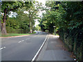
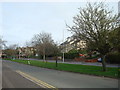
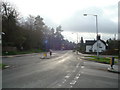
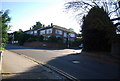
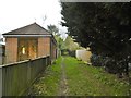
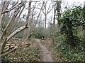
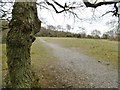
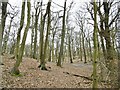
Photos of CR2 0DE
Area Information
The postcode area CR2 0DE occupies a compact residential space of just 4303 square metres, yet it serves as a significant micro-community within the London Borough of Croydon. Residents here form part of a larger context that extends into South Croydon, a historic ward developed in the 19th century from the ancient manors of Croham and Haling. This specific cluster blends modern convenience with deep historical roots, sitting on the southern edge of London where the Brighton Road once served as a key coaching route. The population of this immediate vicinity is approximately 1569 people, creating a close-knit environment distinct from the broader surrounding borough. While CR2 0DE is a small postcode, the area research confirms that the wider region was shaped by the Whitgift Foundation in 1601 and saw significant changes during World War II, including the destruction and subsequent rebuilding of the local bus garage. Life here balances the quietude of a small cluster with the accessibility of major transport hubs like Purley Oaks and Sanderstead stations. For those seeking homes in this postcode, the setting offers a taste of history without isolation, situated near landmarks such as Croham Hurst. The district maintains a density of 364,609 people per square kilometre, reflecting the high concentration of housing typical of established London outer suburbs. ### The community in CR2 0DE is defined by a mature population with a median age of 47 years. Adults aged between 30 and 64 form the most common age range, suggesting a settlement populated by established families and individuals in career stability rather than young students or elderly retirees. This demographic profile aligns with a high level of home ownership, where 83% of residents own their property outright. Such a high ownership rate indicates a stable, settled population with a strong stake in the local community. The predominant ethnic group in this area is White, which mirrors the historical development of the South Croydon ward where the Whitgift School was linked to Haling Manor since 1596. Accommodation types in this postcode are primarily Houses, fitting the character of the 19th-century residential suburbs that developed from the Croham and Haling manors. With a population density of 364,609 people per square kilometre across the 4303 square metre area, living in CR2 0DE feels intimate yet connected. The age and ownership data suggest a neighbourhood where residents are likely to prioritise long-term stability and family-friendly environments, rather than transient rental markets. ### Housing in CR2 0DE is characterised by a stock dominated by Houses, a fact confirmed by the accommodation type data for the postcode area. This structural feature points to a market built on detached, semi-detached, or terraced family homes rather than flats or purpose-built apartments. The relationship between owners and their homes is extremely strong, with 83% of residents classified as homeowners. This high ownership percentage signals that the local property market is driven by owner-occupiers who have likely lived in the area for substantial periods. For buyers looking at homes in this specific cluster, the market dynamics favour those seeking established properties rather than new-build developments typical of younger growth areas. The small geographical footprint of 4303 square metres means that every available property carries significant weight in the local market. The area forms part of the South Croydon ward, where housing emerged from land previously belonging to the ancient manors of Croham and Haling. Consequently, the architectural style and land use will reflect this deep historical lineage. The prevalence of households owning their homes suggests that buyers can expect a stable neighbourhood with fewer short-term movers disrupting the community fabric. ### Digital connectivity for residents of CR2 0DE represents a robust foundation for modern living. The fixed broadband quality score achieves 85 out of 100, categorising this connection level as excellent for remote work, streaming, and high-bandwidth activities. Mobile network coverage also scores 85 out of 100, ensuring that residents maintain reliable communication links while travelling or engaging in outdoor pursuits. Living in this postcode means you can expect minimal technical friction in your daily digital life. These high scores surpass the needs of most standard householders who rely on video calls, online banking, and rapid file transfers. The physical transport network further enhances this connectivity, with five rail stations within practical reach, including Sanderstead, Purley Oaks, and South Croydon Station. The history of the area includes South Croydon Railway which opened in 1863, and the current network continues to serve the district effectively. Five retail outlets and three tram stops, such as Lloyd Park and George Street, provide additional mobility options. Air travel is accessible via Biggin Hill Airport, offering nearby potential for short-haul flights. Whether you work from home or commute centrally, the combination of superior internet speeds and diverse transport links makes CR2 0DE a functionally connected location. ### Residents of CR2 0DE enjoy immediate access to a curated selection of amenities within practical reach. Five major retail locations are nearby, including Tesco Sanderstead, Sainsburys Croydon, and Tesco Croydon, ensuring daily shopping needs are met without long journeys. Transport links are extensive, with five options providing rail connectivity and five tram stops serving stops like Coombe Lane and George Street. For aviation enthusiasts or business travellers, two airports serve the region: Biggin Hill Airport and London Biggin Hill Airport, the latter of which holds historical significance. Leisure activities are supported by Croham Hurst, a 34-hectare woodland area acquired as public open space in 1901 after local campaigns. This green space offers a counterpoint to urban living within the London Borough of Croydon. The area also hosts notable features such as the Croham Manor Road conservation area and the historic Whitgift School, which has been linked to the Whitgift Foundation since 1596. Bus services operate through the historic South Croydon bus garage, which opened in 1916 as coaching stables and was rebuilt after WWII bombing. The layout of the area, emerging from the manors of Croham and Haling, means that daily life blends residential comfort with proximity to commerce and nature. You have everything you need from supermarkets to transport hubs in close proximity. ### Safety profiles for CR2 0DE indicate a secure environment for residents. The crime risk assessment yields a high safety score of 91 out of 100, confirming that this area has below-average crime rates. This low crime risk level means families and individuals can expect a generally quiet neighbourhood consistent with the high home ownership rate of 83%. Planning constraints are minimal, with the area passing all major environmental assessments. There is no flood risk, receiving a perfect pass with a score indicating low flood risk coverage. Similarly, the site has no Ramsar wetland sites, no Area of Outstanding Natural Beauty classification, no protected nature reserves, and no protected woodland. This lack of planning constraints facilitates straightforward building and maintenance of homes in this postcode. The combination of low crime statistics and the absence of environmental restrictions makes CR2 0DE a practical choice for those prioritising security and straightforward property management. The area's history of resilience, including the rebuilding of the bus garage after the 1941 bombing, suggests a community capable of adapting while maintaining stability. Residents can rely on a safety rating that outperforms many London locations. ### Who predominantly lives in CR2 0DE and what is the community like?The community is mature with a median age of 47 years, where adults aged 30 to 64 form the largest group. Eighty-three per cent of residents own their homes, indicating a stable, owner-occupied population. The primary accommodation type is Houses, reflecting the area's character as a residential suburb developed from the ancient manors of Croham and Haling. How good are the transport and internet connections for CR2 0DE?Digital connectivity is excellent, with both fixed broadband and mobile network coverage scoring 85 out of 100. Physical transport is well-supported by five nearby rail stations including Sanderstead and South Croydon, five retail outlets, three tram stops, and two airports including Biggin Hill Airport. Is CR2 0DE safe and are there environmental risks?The area scores a safety rating of 91 out of 100 due to low crime rates. Environmental assessments are clear, showing no flood risk, no Ramsar sites, no AONB status, and no protected nature reserves or woodland, ensuring a clear pathway for property maintenance and potential development. What amenities are within reach for residents of CR2 0DE?Residents have access to five nearby rail stations, five retail locations like Tesco Sanderstead and Sainsburys Croydon, and three tram stops. Leisure options include Croham Hurst, a 34-hectare woodland area purchased in 1901, providing green space close to the residential cluster.
- Area Type
- Postcode
- Area Size
- 4303 m²
- Population
- 1569
- Population Density
- 3399 people/km²
Housing in CR2 0DE is characterised by a stock dominated by Houses, a fact confirmed by the accommodation type data for the postcode area. This structural feature points to a market built on detached, semi-detached, or terraced family homes rather than flats or purpose-built apartments. The relationship between owners and their homes is extremely strong, with 83% of residents classified as homeowners. This high ownership percentage signals that the local property market is driven by owner-occupiers who have likely lived in the area for substantial periods. For buyers looking at homes in this specific cluster, the market dynamics favour those seeking established properties rather than new-build developments typical of younger growth areas. The small geographical footprint of 4303 square metres means that every available property carries significant weight in the local market. The area forms part of the South Croydon ward, where housing emerged from land previously belonging to the ancient manors of Croham and Haling. Consequently, the architectural style and land use will reflect this deep historical lineage. The prevalence of households owning their homes suggests that buyers can expect a stable neighbourhood with fewer short-term movers disrupting the community fabric. ### Digital connectivity for residents of CR2 0DE represents a robust foundation for modern living. The fixed broadband quality score achieves 85 out of 100, categorising this connection level as excellent for remote work, streaming, and high-bandwidth activities. Mobile network coverage also scores 85 out of 100, ensuring that residents maintain reliable communication links while travelling or engaging in outdoor pursuits. Living in this postcode means you can expect minimal technical friction in your daily digital life. These high scores surpass the needs of most standard householders who rely on video calls, online banking, and rapid file transfers. The physical transport network further enhances this connectivity, with five rail stations within practical reach, including Sanderstead, Purley Oaks, and South Croydon Station. The history of the area includes South Croydon Railway which opened in 1863, and the current network continues to serve the district effectively. Five retail outlets and three tram stops, such as Lloyd Park and George Street, provide additional mobility options. Air travel is accessible via Biggin Hill Airport, offering nearby potential for short-haul flights. Whether you work from home or commute centrally, the combination of superior internet speeds and diverse transport links makes CR2 0DE a functionally connected location. ### Residents of CR2 0DE enjoy immediate access to a curated selection of amenities within practical reach. Five major retail locations are nearby, including Tesco Sanderstead, Sainsburys Croydon, and Tesco Croydon, ensuring daily shopping needs are met without long journeys. Transport links are extensive, with five options providing rail connectivity and five tram stops serving stops like Coombe Lane and George Street. For aviation enthusiasts or business travellers, two airports serve the region: Biggin Hill Airport and London Biggin Hill Airport, the latter of which holds historical significance. Leisure activities are supported by Croham Hurst, a 34-hectare woodland area acquired as public open space in 1901 after local campaigns. This green space offers a counterpoint to urban living within the London Borough of Croydon. The area also hosts notable features such as the Croham Manor Road conservation area and the historic Whitgift School, which has been linked to the Whitgift Foundation since 1596. Bus services operate through the historic South Croydon bus garage, which opened in 1916 as coaching stables and was rebuilt after WWII bombing. The layout of the area, emerging from the manors of Croham and Haling, means that daily life blends residential comfort with proximity to commerce and nature. You have everything you need from supermarkets to transport hubs in close proximity. ### Safety profiles for CR2 0DE indicate a secure environment for residents. The crime risk assessment yields a high safety score of 91 out of 100, confirming that this area has below-average crime rates. This low crime risk level means families and individuals can expect a generally quiet neighbourhood consistent with the high home ownership rate of 83%. Planning constraints are minimal, with the area passing all major environmental assessments. There is no flood risk, receiving a perfect pass with a score indicating low flood risk coverage. Similarly, the site has no Ramsar wetland sites, no Area of Outstanding Natural Beauty classification, no protected nature reserves, and no protected woodland. This lack of planning constraints facilitates straightforward building and maintenance of homes in this postcode. The combination of low crime statistics and the absence of environmental restrictions makes CR2 0DE a practical choice for those prioritising security and straightforward property management. The area's history of resilience, including the rebuilding of the bus garage after the 1941 bombing, suggests a community capable of adapting while maintaining stability. Residents can rely on a safety rating that outperforms many London locations. ### Who predominantly lives in CR2 0DE and what is the community like?The community is mature with a median age of 47 years, where adults aged 30 to 64 form the largest group. Eighty-three per cent of residents own their homes, indicating a stable, owner-occupied population. The primary accommodation type is Houses, reflecting the area's character as a residential suburb developed from the ancient manors of Croham and Haling. How good are the transport and internet connections for CR2 0DE?Digital connectivity is excellent, with both fixed broadband and mobile network coverage scoring 85 out of 100. Physical transport is well-supported by five nearby rail stations including Sanderstead and South Croydon, five retail outlets, three tram stops, and two airports including Biggin Hill Airport. Is CR2 0DE safe and are there environmental risks?The area scores a safety rating of 91 out of 100 due to low crime rates. Environmental assessments are clear, showing no flood risk, no Ramsar sites, no AONB status, and no protected nature reserves or woodland, ensuring a clear pathway for property maintenance and potential development. What amenities are within reach for residents of CR2 0DE?Residents have access to five nearby rail stations, five retail locations like Tesco Sanderstead and Sainsburys Croydon, and three tram stops. Leisure options include Croham Hurst, a 34-hectare woodland area purchased in 1901, providing green space close to the residential cluster.
House Prices in CR2 0DE
Showing 7 properties
| Address | Type | Beds | Baths | Last Sale Price | Last Sale Date | |
|---|---|---|---|---|---|---|
| 396 Selsdon Road, South Croydon, CR2 0DE | Detached | 3 | - | £665,000 | Dec 2018 | |
| 388 Selsdon Road, South Croydon, CR2 0DE | Bungalow | 3 | - | £315,000 | Jan 2012 | |
| 394 Selsdon Road, South Croydon, CR2 0DE | house | - | - | £455,000 | Jun 2007 | |
| Rowsley, 398 Selsdon Road, South Croydon, CR2 0DE | Detached | 6 | 1 | - | - | |
| 394 Selsdon Avenue, South Croydon, CR2 0DE | undefined | - | - | - | - | |
| 392 Selsdon Road, South Croydon, CR2 0DE | Detached | - | - | - | - | |
| 390 Selsdon Road, South Croydon, CR2 0DE | Terraced | 3 | 2 | - | - |
Energy Efficiency in CR2 0DE
Residents of CR2 0DE enjoy immediate access to a curated selection of amenities within practical reach. Five major retail locations are nearby, including Tesco Sanderstead, Sainsburys Croydon, and Tesco Croydon, ensuring daily shopping needs are met without long journeys. Transport links are extensive, with five options providing rail connectivity and five tram stops serving stops like Coombe Lane and George Street. For aviation enthusiasts or business travellers, two airports serve the region: Biggin Hill Airport and London Biggin Hill Airport, the latter of which holds historical significance. Leisure activities are supported by Croham Hurst, a 34-hectare woodland area acquired as public open space in 1901 after local campaigns. This green space offers a counterpoint to urban living within the London Borough of Croydon. The area also hosts notable features such as the Croham Manor Road conservation area and the historic Whitgift School, which has been linked to the Whitgift Foundation since 1596. Bus services operate through the historic South Croydon bus garage, which opened in 1916 as coaching stables and was rebuilt after WWII bombing. The layout of the area, emerging from the manors of Croham and Haling, means that daily life blends residential comfort with proximity to commerce and nature. You have everything you need from supermarkets to transport hubs in close proximity. ### Safety profiles for CR2 0DE indicate a secure environment for residents. The crime risk assessment yields a high safety score of 91 out of 100, confirming that this area has below-average crime rates. This low crime risk level means families and individuals can expect a generally quiet neighbourhood consistent with the high home ownership rate of 83%. Planning constraints are minimal, with the area passing all major environmental assessments. There is no flood risk, receiving a perfect pass with a score indicating low flood risk coverage. Similarly, the site has no Ramsar wetland sites, no Area of Outstanding Natural Beauty classification, no protected nature reserves, and no protected woodland. This lack of planning constraints facilitates straightforward building and maintenance of homes in this postcode. The combination of low crime statistics and the absence of environmental restrictions makes CR2 0DE a practical choice for those prioritising security and straightforward property management. The area's history of resilience, including the rebuilding of the bus garage after the 1941 bombing, suggests a community capable of adapting while maintaining stability. Residents can rely on a safety rating that outperforms many London locations. ### Who predominantly lives in CR2 0DE and what is the community like?The community is mature with a median age of 47 years, where adults aged 30 to 64 form the largest group. Eighty-three per cent of residents own their homes, indicating a stable, owner-occupied population. The primary accommodation type is Houses, reflecting the area's character as a residential suburb developed from the ancient manors of Croham and Haling. How good are the transport and internet connections for CR2 0DE?Digital connectivity is excellent, with both fixed broadband and mobile network coverage scoring 85 out of 100. Physical transport is well-supported by five nearby rail stations including Sanderstead and South Croydon, five retail outlets, three tram stops, and two airports including Biggin Hill Airport. Is CR2 0DE safe and are there environmental risks?The area scores a safety rating of 91 out of 100 due to low crime rates. Environmental assessments are clear, showing no flood risk, no Ramsar sites, no AONB status, and no protected nature reserves or woodland, ensuring a clear pathway for property maintenance and potential development. What amenities are within reach for residents of CR2 0DE?Residents have access to five nearby rail stations, five retail locations like Tesco Sanderstead and Sainsburys Croydon, and three tram stops. Leisure options include Croham Hurst, a 34-hectare woodland area purchased in 1901, providing green space close to the residential cluster.
Amenities
Schools
| Rank | School | Type | Entry gender | Ages |
|---|
Explore more schools in this area
Go to Schools tabDemographics
The community in CR2 0DE is defined by a mature population with a median age of 47 years. Adults aged between 30 and 64 form the most common age range, suggesting a settlement populated by established families and individuals in career stability rather than young students or elderly retirees. This demographic profile aligns with a high level of home ownership, where 83% of residents own their property outright. Such a high ownership rate indicates a stable, settled population with a strong stake in the local community. The predominant ethnic group in this area is White, which mirrors the historical development of the South Croydon ward where the Whitgift School was linked to Haling Manor since 1596. Accommodation types in this postcode are primarily Houses, fitting the character of the 19th-century residential suburbs that developed from the Croham and Haling manors. With a population density of 364,609 people per square kilometre across the 4303 square metre area, living in CR2 0DE feels intimate yet connected. The age and ownership data suggest a neighbourhood where residents are likely to prioritise long-term stability and family-friendly environments, rather than transient rental markets. ### Housing in CR2 0DE is characterised by a stock dominated by Houses, a fact confirmed by the accommodation type data for the postcode area. This structural feature points to a market built on detached, semi-detached, or terraced family homes rather than flats or purpose-built apartments. The relationship between owners and their homes is extremely strong, with 83% of residents classified as homeowners. This high ownership percentage signals that the local property market is driven by owner-occupiers who have likely lived in the area for substantial periods. For buyers looking at homes in this specific cluster, the market dynamics favour those seeking established properties rather than new-build developments typical of younger growth areas. The small geographical footprint of 4303 square metres means that every available property carries significant weight in the local market. The area forms part of the South Croydon ward, where housing emerged from land previously belonging to the ancient manors of Croham and Haling. Consequently, the architectural style and land use will reflect this deep historical lineage. The prevalence of households owning their homes suggests that buyers can expect a stable neighbourhood with fewer short-term movers disrupting the community fabric. ### Digital connectivity for residents of CR2 0DE represents a robust foundation for modern living. The fixed broadband quality score achieves 85 out of 100, categorising this connection level as excellent for remote work, streaming, and high-bandwidth activities. Mobile network coverage also scores 85 out of 100, ensuring that residents maintain reliable communication links while travelling or engaging in outdoor pursuits. Living in this postcode means you can expect minimal technical friction in your daily digital life. These high scores surpass the needs of most standard householders who rely on video calls, online banking, and rapid file transfers. The physical transport network further enhances this connectivity, with five rail stations within practical reach, including Sanderstead, Purley Oaks, and South Croydon Station. The history of the area includes South Croydon Railway which opened in 1863, and the current network continues to serve the district effectively. Five retail outlets and three tram stops, such as Lloyd Park and George Street, provide additional mobility options. Air travel is accessible via Biggin Hill Airport, offering nearby potential for short-haul flights. Whether you work from home or commute centrally, the combination of superior internet speeds and diverse transport links makes CR2 0DE a functionally connected location. ### Residents of CR2 0DE enjoy immediate access to a curated selection of amenities within practical reach. Five major retail locations are nearby, including Tesco Sanderstead, Sainsburys Croydon, and Tesco Croydon, ensuring daily shopping needs are met without long journeys. Transport links are extensive, with five options providing rail connectivity and five tram stops serving stops like Coombe Lane and George Street. For aviation enthusiasts or business travellers, two airports serve the region: Biggin Hill Airport and London Biggin Hill Airport, the latter of which holds historical significance. Leisure activities are supported by Croham Hurst, a 34-hectare woodland area acquired as public open space in 1901 after local campaigns. This green space offers a counterpoint to urban living within the London Borough of Croydon. The area also hosts notable features such as the Croham Manor Road conservation area and the historic Whitgift School, which has been linked to the Whitgift Foundation since 1596. Bus services operate through the historic South Croydon bus garage, which opened in 1916 as coaching stables and was rebuilt after WWII bombing. The layout of the area, emerging from the manors of Croham and Haling, means that daily life blends residential comfort with proximity to commerce and nature. You have everything you need from supermarkets to transport hubs in close proximity. ### Safety profiles for CR2 0DE indicate a secure environment for residents. The crime risk assessment yields a high safety score of 91 out of 100, confirming that this area has below-average crime rates. This low crime risk level means families and individuals can expect a generally quiet neighbourhood consistent with the high home ownership rate of 83%. Planning constraints are minimal, with the area passing all major environmental assessments. There is no flood risk, receiving a perfect pass with a score indicating low flood risk coverage. Similarly, the site has no Ramsar wetland sites, no Area of Outstanding Natural Beauty classification, no protected nature reserves, and no protected woodland. This lack of planning constraints facilitates straightforward building and maintenance of homes in this postcode. The combination of low crime statistics and the absence of environmental restrictions makes CR2 0DE a practical choice for those prioritising security and straightforward property management. The area's history of resilience, including the rebuilding of the bus garage after the 1941 bombing, suggests a community capable of adapting while maintaining stability. Residents can rely on a safety rating that outperforms many London locations. ### Who predominantly lives in CR2 0DE and what is the community like?The community is mature with a median age of 47 years, where adults aged 30 to 64 form the largest group. Eighty-three per cent of residents own their homes, indicating a stable, owner-occupied population. The primary accommodation type is Houses, reflecting the area's character as a residential suburb developed from the ancient manors of Croham and Haling. How good are the transport and internet connections for CR2 0DE?Digital connectivity is excellent, with both fixed broadband and mobile network coverage scoring 85 out of 100. Physical transport is well-supported by five nearby rail stations including Sanderstead and South Croydon, five retail outlets, three tram stops, and two airports including Biggin Hill Airport. Is CR2 0DE safe and are there environmental risks?The area scores a safety rating of 91 out of 100 due to low crime rates. Environmental assessments are clear, showing no flood risk, no Ramsar sites, no AONB status, and no protected nature reserves or woodland, ensuring a clear pathway for property maintenance and potential development. What amenities are within reach for residents of CR2 0DE?Residents have access to five nearby rail stations, five retail locations like Tesco Sanderstead and Sainsburys Croydon, and three tram stops. Leisure options include Croham Hurst, a 34-hectare woodland area purchased in 1901, providing green space close to the residential cluster.
Household Size
Accommodation Type
Tenure
Ethnic Group
Religion
Household Composition
Age
Household Deprivation
NS-SEC
Explore more demographic insights in this area
Go to Demographics tabPlanning
Planning Constraints
- Flood RiskPremium
- Ramsar Wetland SitesPremium
- Area of Outstanding Natural BeautyPremium
- Protected Nature ReservePremium
- Protected WoodlandPremium