Area Overview for CR0 3BF
Photos of CR0 3BF
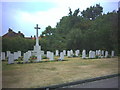
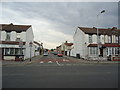
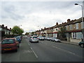
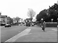
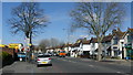
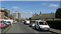
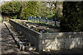
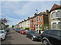
44 photos from this area
Area Information
Key information about the CR0 3BF including its size, population, and administrative classification.
- Area Type
- Postcode
- Area Size
- 6.3 hectares
- Population
- 1847
- Population Density
- 7321 people/km²
House Prices in CR0 3BF
60
Properties
£220,771
Average Sold Price
£40,000
Lowest Price
£445,000
Highest Price
Showing 60 properties
| Address | Type | Beds | Baths | Last Sale Price | Last Sale Date | |
|---|---|---|---|---|---|---|
| 81 Aurelia Road, Croydon, CR0 3BF | Terraced | 3 | 1 | £370,000 | Oct 2025 | |
| 155 Aurelia Road, Croydon, CR0 3BF | house | - | - | £390,000 | May 2022 | |
| 79 Aurelia Road, Croydon, CR0 3BF | Terraced | 3 | 1 | £378,000 | May 2021 | |
| 73 Aurelia Road, Croydon, CR0 3BF | Detached | 3 | 1 | £350,000 | Nov 2020 | |
| 97 Aurelia Road, Croydon, CR0 3BF | Terraced | 3 | 1 | £445,000 | Nov 2017 | |
| 107 Aurelia Road, Croydon, CR0 3BF | house | - | - | £275,000 | Jul 2015 | |
| 83 Aurelia Road, Croydon, CR0 3BF | house | - | - | £190,000 | Nov 2013 | |
| 91 Aurelia Road, Croydon, CR0 3BF | Terraced | 3 | 1 | £176,000 | Feb 2013 | |
| 103 Aurelia Road, Croydon, CR0 3BF | Terraced | 3 | - | £220,000 | Dec 2009 | |
| 89 Aurelia Road, Croydon, CR0 3BF | Terraced | 3 | 1 | £232,500 | Sep 2008 |
Page 1 of 6
Energy Efficiency in CR0 3BF
Amenities
Schools
| Rank | School | Type | Entry gender | Ages |
|---|
Explore more schools in this area
Go to Schools tabDemographics
Household Size
Family (3-5 people)
most common
Accommodation Type
Houses
most common
Tenure
50
majority
Ethnic Group
asian_total
most common
Religion
N/A
most common
Household Composition
N/A
most common
Age
47
median
Adults (30-64 years)
most common
Household Deprivation
N/A
with no deprivation
NS-SEC
26
in Lower managerial occupations
Explore more demographic insights in this area
Go to Demographics tabPlanning
Planning Constraints
- Flood RiskPremium
- Ramsar Wetland SitesPremium
- Area of Outstanding Natural BeautyPremium
- Protected Nature ReservePremium
- Protected WoodlandPremium