Area Overview for CR0 0ET
Photos of CR0 0ET

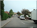
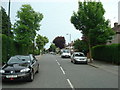
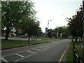
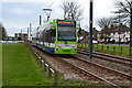
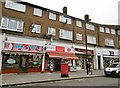

55 photos from this area
Area Information
Key information about the CR0 0ET including its size, population, and administrative classification.
- Area Type
- Postcode
- Area Size
- 1.2 hectares
- Population
- Not available
- Population Density
- Not available
House Prices in CR0 0ET
23
Properties
£206,325
Average Sold Price
£56,800
Lowest Price
£365,000
Highest Price
Showing 23 properties
| Address | Type | Beds | Baths | Last Sale Price | Last Sale Date | |
|---|---|---|---|---|---|---|
| 19 Hares Bank, Croydon, CR0 0ET | Maisonette | 3 | - | £293,000 | Jun 2025 | |
| 7 Hares Bank, Croydon, CR0 0ET | Semi-detached | 2 | 1 | £365,000 | Oct 2024 | |
| 43 Hares Bank, Croydon, CR0 0ET | Semi-detached | 2 | 1 | £325,000 | Sep 2018 | |
| 5 Hares Bank, Croydon, CR0 0ET | Semi-detached | 2 | 1 | £249,000 | Aug 2014 | |
| 13 Hares Bank, Croydon, CR0 0ET | Maisonette | 3 | - | £170,000 | Dec 2013 | |
| 15 Hares Bank, Croydon, CR0 0ET | Flat | - | - | £173,950 | May 2007 | |
| 23 Hares Bank, Croydon, CR0 0ET | Flat | - | - | £153,500 | Mar 2006 | |
| 39 Hares Bank, Croydon, CR0 0ET | house | - | - | £190,000 | Sep 2004 | |
| 37 Hares Bank, Croydon, CR0 0ET | house | - | - | £87,000 | Jan 1999 | |
| 21 Hares Bank, Croydon, CR0 0ET | Flat | - | - | £56,800 | Jun 1998 |
Page 1 of 3
Energy Efficiency in CR0 0ET
Amenities
Schools
| Rank | School | Type | Entry gender | Ages |
|---|
Explore more schools in this area
Go to Schools tabDemographics
Household Size
Family (3-5 people)
most common
Accommodation Type
Houses
most common
Tenure
48
majority
Ethnic Group
White
most common
Religion
N/A
most common
Household Composition
N/A
most common
Age
47
median
Adults (30-64 years)
most common
Household Deprivation
N/A
with no deprivation
NS-SEC
23
in Lower managerial occupations
Explore more demographic insights in this area
Go to Demographics tabPlanning
Planning Constraints
- Flood RiskPremium
- Ramsar Wetland SitesPremium
- Area of Outstanding Natural BeautyPremium
- Protected Nature ReservePremium
- Protected WoodlandPremium