Area Overview for CR0 0AS
Photos of CR0 0AS
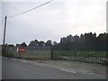
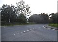

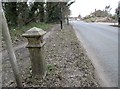
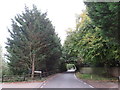
45 photos from this area
Area Information
Key information about the CR0 0AS including its size, population, and administrative classification.
- Area Type
- Postcode
- Area Size
- 1.3 hectares
- Population
- 1614
- Population Density
- 5330 people/km²
House Prices in CR0 0AS
36
Properties
£260,615
Average Sold Price
£88,500
Lowest Price
£365,000
Highest Price
Showing 36 properties
| Address | Type | Beds | Baths | Last Sale Price | Last Sale Date | |
|---|---|---|---|---|---|---|
| 70 Warbank Crescent, Croydon, CR0 0AS | house | 2 | 1 | £365,000 | Jun 2025 | |
| 14 Warbank Crescent, Croydon, CR0 0AS | house | - | - | £330,000 | Mar 2025 | |
| 28 Warbank Crescent, Croydon, CR0 0AS | house | - | - | £340,000 | Jun 2022 | |
| 58 Warbank Crescent, Croydon, CR0 0AS | Terraced | 3 | 1 | £340,000 | Sep 2021 | |
| 60 Warbank Crescent, Croydon, CR0 0AS | Semi-detached | 1 | 2 | £310,500 | Jun 2018 | |
| 18 Warbank Crescent, Croydon, CR0 0AS | house | 3 | - | £355,000 | Aug 2017 | |
| 64 Warbank Crescent, Croydon, CR0 0AS | Semi-detached | 2 | 1 | £287,000 | Feb 2016 | |
| 52 Warbank Crescent, Croydon, CR0 0AS | Terraced | 3 | - | £206,000 | Sep 2013 | |
| 56 Warbank Crescent, Croydon, CR0 0AS | house | - | - | £218,000 | Aug 2010 | |
| 48 Warbank Crescent, Croydon, CR0 0AS | Terraced | 3 | - | £215,000 | Feb 2008 |
Page 1 of 4
Energy Efficiency in CR0 0AS
Amenities
Schools
| Rank | School | Type | Entry gender | Ages |
|---|
Explore more schools in this area
Go to Schools tabDemographics
Household Size
Family (3-5 people)
most common
Accommodation Type
Houses
most common
Tenure
47
majority
Ethnic Group
White
most common
Religion
N/A
most common
Household Composition
N/A
most common
Age
47
median
Adults (30-64 years)
most common
Household Deprivation
N/A
with no deprivation
NS-SEC
23
in Lower managerial occupations
Explore more demographic insights in this area
Go to Demographics tabPlanning
Planning Constraints
- Flood RiskPremium
- Ramsar Wetland SitesPremium
- Area of Outstanding Natural BeautyPremium
- Protected Nature ReservePremium
- Protected WoodlandPremium