Area Overview for CR0 0AE
Photos of CR0 0AE
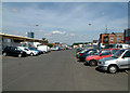


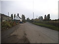
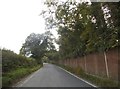
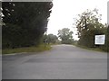
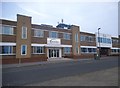
52 photos from this area
Area Information
Key information about the CR0 0AE including its size, population, and administrative classification.
- Area Type
- Postcode
- Area Size
- 3.8 hectares
- Population
- 1614
- Population Density
- 5330 people/km²
House Prices in CR0 0AE
25
Properties
£241,000
Average Sold Price
£133,000
Lowest Price
£415,000
Highest Price
Showing 25 properties
| Address | Type | Beds | Baths | Last Sale Price | Last Sale Date | |
|---|---|---|---|---|---|---|
| 287 King Henrys Drive, Croydon, CR0 0AE | Terraced | 3 | 1 | £330,000 | Aug 2024 | |
| 283 King Henrys Drive, Croydon, CR0 0AE | house | 4 | - | £415,000 | Feb 2021 | |
| 289 King Henrys Drive, Croydon, CR0 0AE | Terraced | 3 | 1 | £325,000 | Jan 2019 | |
| 305 King Henrys Drive, Croydon, CR0 0AE | Semi-detached | 3 | - | £250,000 | Sep 2014 | |
| 309 King Henrys Drive, Croydon, CR0 0AE | house | - | - | £172,000 | Feb 2006 | |
| 297 King Henrys Drive, Croydon, CR0 0AE | house | - | - | £187,000 | Jun 2005 | |
| 317 King Henrys Drive, Croydon, CR0 0AE | house | - | - | £220,000 | Feb 2005 | |
| 281 King Henrys Drive, Croydon, CR0 0AE | Terraced | - | - | £137,000 | Sep 2002 | |
| 293 King Henrys Drive, Croydon, CR0 0AE | Terraced | - | - | £133,000 | May 2002 | |
| 313 King Henrys Drive, Croydon, CR0 0AE | Detached | 3 | 1 | - | - |
Page 1 of 3
Energy Efficiency in CR0 0AE
Amenities
Schools
| Rank | School | Type | Entry gender | Ages |
|---|
Explore more schools in this area
Go to Schools tabDemographics
Household Size
Family (3-5 people)
most common
Accommodation Type
Houses
most common
Tenure
47
majority
Ethnic Group
White
most common
Religion
N/A
most common
Household Composition
N/A
most common
Age
47
median
Adults (30-64 years)
most common
Household Deprivation
N/A
with no deprivation
NS-SEC
23
in Lower managerial occupations
Explore more demographic insights in this area
Go to Demographics tabPlanning
Planning Constraints
- Flood RiskPremium
- Ramsar Wetland SitesPremium
- Area of Outstanding Natural BeautyPremium
- Protected Nature ReservePremium
- Protected WoodlandPremium