Area Overview for BR7 6NF
Photos of BR7 6NF
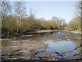
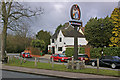

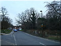
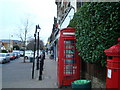
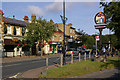


67 photos from this area
Area Information
Key information about the BR7 6NF including its size, population, and administrative classification.
- Area Type
- Postcode
- Area Size
- 5077 m²
- Population
- 1636
- Population Density
- 1180 people/km²
House Prices in BR7 6NF
21
Properties
£334,866
Average Sold Price
£60,000
Lowest Price
£470,000
Highest Price
Showing 21 properties
| Address | Type | Beds | Baths | Last Sale Price | Last Sale Date | |
|---|---|---|---|---|---|---|
| 16, Inglewood, Kemnal Road, Chislehurst, BR7 6NF | Flat | 2 | 1 | £420,000 | Jan 2025 | |
| 10, Inglewood, Kemnal Road, Chislehurst, BR7 6NF | Flat | - | - | £470,000 | Sep 2024 | |
| 6, Inglewood, Kemnal Road, Chislehurst, BR7 6NF | Flat | - | - | £430,000 | Aug 2024 | |
| 20, Inglewood, Kemnal Road, Chislehurst, BR7 6NF | Flat | - | - | £440,000 | Aug 2022 | |
| 12, Inglewood, Kemnal Road, Chislehurst, BR7 6NF | Flat | - | - | £437,000 | Mar 2021 | |
| 8, Inglewood, Kemnal Road, Chislehurst, BR7 6NF | Flat | - | - | £379,995 | Jan 2021 | |
| 21, Inglewood, Kemnal Road, Chislehurst, BR7 6NF | Flat | - | - | £380,000 | Nov 2020 | |
| 4, Inglewood, Kemnal Road, Chislehurst, BR7 6NF | Flat | 2 | 2 | £375,000 | Sep 2019 | |
| 1, Inglewood, Kemnal Road, Chislehurst, BR7 6NF | Flat | 2 | 1 | £362,000 | Jun 2018 | |
| 9, Inglewood, Kemnal Road, Chislehurst, BR7 6NF | Flat | 2 | 1 | £360,000 | May 2015 |
Page 1 of 3
Energy Efficiency in BR7 6NF
Amenities
Schools
| Rank | School | Type | Entry gender | Ages |
|---|
Explore more schools in this area
Go to Schools tabDemographics
Household Size
Family (3-5 people)
most common
Accommodation Type
Houses
most common
Tenure
59
majority
Ethnic Group
White
most common
Religion
N/A
most common
Household Composition
N/A
most common
Age
47
median
Adults (30-64 years)
most common
Household Deprivation
N/A
with no deprivation
NS-SEC
38
in Lower managerial occupations
Explore more demographic insights in this area
Go to Demographics tabPlanning
Planning Constraints
- Flood RiskPremium
- Ramsar Wetland SitesPremium
- Area of Outstanding Natural BeautyPremium
- Protected Nature ReservePremium
- Protected WoodlandPremium