Area Overview for BR6 7DB
Photos of BR6 7DB
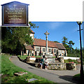
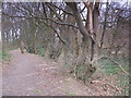
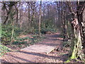
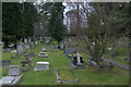
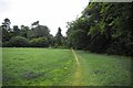
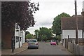
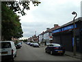
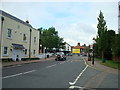
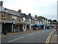
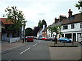

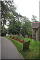
97 photos from this area
Area Information
Key information about the BR6 7DB including its size, population, and administrative classification.
- Area Type
- Postcode
- Area Size
- 31.0 hectares
- Population
- 1747
- Population Density
- 1263 people/km²
House Prices in BR6 7DB
33
Properties
£305,058
Average Sold Price
£210,000
Lowest Price
£473,250
Highest Price
Showing 33 properties
| Address | Type | Beds | Baths | Last Sale Price | Last Sale Date | |
|---|---|---|---|---|---|---|
| 16 Church Road, Farnborough, Orpington, BR6 7DB | Terraced | 2 | 1 | £320,000 | May 2018 | |
| 8 Church Road, Farnborough, Orpington, BR6 7DB | Flat | - | - | £260,000 | Mar 2018 | |
| 7A Church Road, Farnborough, Orpington, BR6 7DB | house | 1 | 1 | £315,000 | Jan 2018 | |
| Little Door Cottage, 18 Church Road, Farnborough, Orpington, BR6 7DB | Cottage | 2 | - | £460,000 | Sep 2017 | |
| 2A Church Road, Farnborough, Orpington, BR6 7DB | Flat | 2 | 1 | £390,000 | Jan 2015 | |
| 15 Church Road, Farnborough, Orpington, BR6 7DB | Detached | 3 | - | £473,250 | Jul 2014 | |
| 20 Church Road, Farnborough, Orpington, BR6 7DB | Cottage | 3 | 1 | £335,000 | Mar 2013 | |
| 3A Church Road, Farnborough, Orpington, BR6 7DB | Flat | - | - | £235,000 | Jan 2013 | |
| 9 Church Road, Farnborough, Orpington, BR6 7DB | Detached | 1 | 1 | £227,000 | Dec 2011 | |
| 1 Church Road, Farnborough, Orpington, BR6 7DB | Terraced | 1 | 1 | £288,000 | Jun 2011 |
Page 1 of 4
Energy Efficiency in BR6 7DB
Amenities
Schools
| Rank | School | Type | Entry gender | Ages |
|---|
Explore more schools in this area
Go to Schools tabDemographics
Household Size
One person
most common
Accommodation Type
Houses
most common
Tenure
79
majority
Ethnic Group
White
most common
Religion
N/A
most common
Household Composition
N/A
most common
Age
47
median
Adults (30-64 years)
most common
Household Deprivation
N/A
with no deprivation
NS-SEC
41
in Lower managerial occupations
Explore more demographic insights in this area
Go to Demographics tabPlanning
Planning Constraints
- Flood RiskPremium
- Ramsar Wetland SitesPremium
- Area of Outstanding Natural BeautyPremium
- Protected Nature ReservePremium
- Protected WoodlandPremium