Area Overview for BR6 7HH
Photos of BR6 7HH
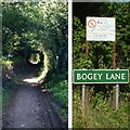
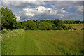
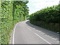
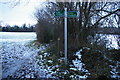
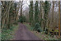
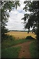

85 photos from this area
Area Information
Key information about the BR6 7HH including its size, population, and administrative classification.
- Area Type
- Postcode
- Area Size
- 1.2 km²
- Population
- 2264
- Population Density
- 1232 people/km²
House Prices in BR6 7HH
7
Properties
£914,239
Average Sold Price
£295,000
Lowest Price
£2,018,696
Highest Price
Showing 7 properties
| Address | Type | Beds | Baths | Last Sale Price | Last Sale Date | |
|---|---|---|---|---|---|---|
| LOWER HOOK FARMHOUSE, SHIRE LANE, Farnborough, Orpington, BR6 7HH | Detached | 4 | 2 | £1,015,000 | May 2023 | |
| Sevenoaks Lodge, Shire Lane, Farnborough, Orpington, BR6 7HH | Detached | - | - | £810,000 | Oct 2008 | |
| Deanery Grange, Shire Lane, Farnborough, Orpington, BR6 7HH | Detached | 5 | 4 | £2,018,696 | Apr 2004 | |
| Old Lodge, Shire Lane, Farnborough, Orpington, BR6 7HH | Detached | 3 | 2 | £432,500 | Feb 2004 | |
| Lichen Cottage, Shire Lane, Farnborough, Orpington, BR6 7HH | house | 3 | - | £295,000 | Mar 1998 | |
| Woodlands Poultry Farm, Shire Lane, Farnborough, Orpington, BR6 7HH | Detached | - | - | - | - | |
| High Larches, Shire Lane, Farnborough, Orpington, BR6 7HH | house | - | - | - | - |
Energy Efficiency in BR6 7HH
Amenities
Schools
| Rank | School | Type | Entry gender | Ages |
|---|
Explore more schools in this area
Go to Schools tabDemographics
Household Size
Family (3-5 people)
most common
Accommodation Type
Houses
most common
Tenure
83
majority
Ethnic Group
White
most common
Religion
N/A
most common
Household Composition
N/A
most common
Age
47
median
Adults (30-64 years)
most common
Household Deprivation
N/A
with no deprivation
NS-SEC
48
in Lower managerial occupations
Explore more demographic insights in this area
Go to Demographics tabPlanning
Planning Constraints
- Flood RiskPremium
- Ramsar Wetland SitesPremium
- Area of Outstanding Natural BeautyPremium
- Protected Nature ReservePremium
- Protected WoodlandPremium