Area Overview for BR6 0BP
Photos of BR6 0BP
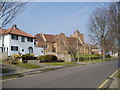
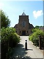
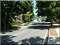
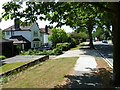
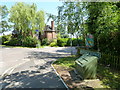
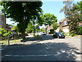
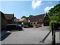
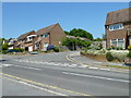
100 photos from this area
Area Information
Key information about the BR6 0BP including its size, population, and administrative classification.
- Area Type
- Postcode
- Area Size
- 1.1 hectares
- Population
- 1561
- Population Density
- 4678 people/km²
House Prices in BR6 0BP
22
Properties
£600,397
Average Sold Price
£199,950
Lowest Price
£1,270,000
Highest Price
Showing 22 properties
| Address | Type | Beds | Baths | Last Sale Price | Last Sale Date | |
|---|---|---|---|---|---|---|
| 191 Crofton Lane, Orpington, BR6 0BP | Semi-detached | 3 | - | £570,000 | Mar 2024 | |
| 195 Crofton Lane, Orpington, BR6 0BP | Retail | 3 | 2 | £730,000 | May 2022 | |
| 161 Crofton Lane, Orpington, BR6 0BP | Detached | 3 | 4 | £1,100,000 | Sep 2021 | |
| 165 Crofton Lane, Orpington, BR6 0BP | Detached | 5 | 4 | £1,270,000 | Sep 2021 | |
| 175 Crofton Lane, Orpington, BR6 0BP | Detached | 3 | 1 | £726,000 | Jun 2021 | |
| 177 Crofton Lane, Orpington, BR6 0BP | Semi-detached | 4 | - | £565,000 | Jul 2019 | |
| 181 Crofton Lane, Orpington, BR6 0BP | Semi-detached | 3 | - | £585,000 | Dec 2018 | |
| 167 Crofton Lane, Orpington, BR6 0BP | house | 5 | 4 | £1,028,000 | Jan 2014 | |
| 199 Crofton Lane, Orpington, BR6 0BP | Detached | 3 | 2 | £450,000 | Feb 2013 | |
| 193 Crofton Lane, Orpington, BR6 0BP | Semi-detached | 5 | 2 | £370,000 | Oct 2011 |
Page 1 of 3
Energy Efficiency in BR6 0BP
Amenities
Schools
| Rank | School | Type | Entry gender | Ages |
|---|
Explore more schools in this area
Go to Schools tabDemographics
Household Size
Family (3-5 people)
most common
Accommodation Type
Houses
most common
Tenure
86
majority
Ethnic Group
White
most common
Religion
N/A
most common
Household Composition
N/A
most common
Age
47
median
Adults (30-64 years)
most common
Household Deprivation
N/A
with no deprivation
NS-SEC
53
in Lower managerial occupations
Explore more demographic insights in this area
Go to Demographics tabPlanning
Planning Constraints
- Flood RiskPremium
- Ramsar Wetland SitesPremium
- Area of Outstanding Natural BeautyPremium
- Protected Nature ReservePremium
- Protected WoodlandPremium