Area Overview for BR5 3DX
Photos of BR5 3DX


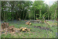
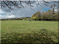
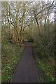
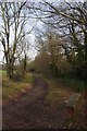


59 photos from this area
Area Information
Key information about the BR5 3DX including its size, population, and administrative classification.
- Area Type
- Postcode
- Area Size
- 7.6 hectares
- Population
- 1511
- Population Density
- 567 people/km²
House Prices in BR5 3DX
36
Properties
£267,778
Average Sold Price
£60,000
Lowest Price
£465,000
Highest Price
Showing 36 properties
| Address | Type | Beds | Baths | Last Sale Price | Last Sale Date | |
|---|---|---|---|---|---|---|
| 101 Lullingstone Crescent, Orpington, BR5 3DX | Semi-detached | 3 | 1 | £420,000 | Jul 2024 | |
| 124 Lullingstone Crescent, Orpington, BR5 3DX | Terraced | 3 | 1 | £300,000 | Jun 2024 | |
| 134 Lullingstone Crescent, Orpington, BR5 3DX | Semi-detached | 4 | 2 | £435,000 | May 2024 | |
| 140 Lullingstone Crescent, Orpington, BR5 3DX | Semi-detached | 3 | 1 | £465,000 | Nov 2022 | |
| 118 Lullingstone Crescent, Orpington, BR5 3DX | Terraced | 3 | 2 | £450,000 | Sep 2022 | |
| 138 Lullingstone Crescent, Orpington, BR5 3DX | Semi-detached | 3 | 1 | £395,000 | Dec 2020 | |
| 122 Lullingstone Crescent, Orpington, BR5 3DX | Terraced | 3 | 1 | £340,000 | Aug 2019 | |
| 106 Lullingstone Crescent, Orpington, BR5 3DX | house | 3 | 1 | £332,500 | Apr 2019 | |
| 105 Lullingstone Crescent, Orpington, BR5 3DX | Semi-detached | 3 | 1 | £325,000 | Apr 2016 | |
| 128 Lullingstone Crescent, Orpington, BR5 3DX | Terraced | 4 | - | £294,000 | Oct 2015 |
Page 1 of 4
Energy Efficiency in BR5 3DX
Amenities
Schools
| Rank | School | Type | Entry gender | Ages |
|---|
Explore more schools in this area
Go to Schools tabDemographics
Household Size
One person
most common
Accommodation Type
Houses
most common
Tenure
81
majority
Ethnic Group
White
most common
Religion
N/A
most common
Household Composition
N/A
most common
Age
47
median
Adults (30-64 years)
most common
Household Deprivation
N/A
with no deprivation
NS-SEC
46
in Lower managerial occupations
Explore more demographic insights in this area
Go to Demographics tabPlanning
Planning Constraints
- Flood RiskPremium
- Ramsar Wetland SitesPremium
- Area of Outstanding Natural BeautyPremium
- Protected Nature ReservePremium
- Protected WoodlandPremium