Area Overview for BR5 3DU
Photos of BR5 3DU


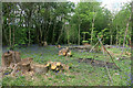
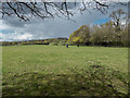
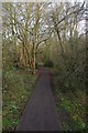
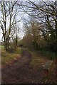
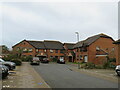
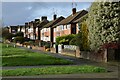
59 photos from this area
Area Information
Key information about the BR5 3DU including its size, population, and administrative classification.
- Area Type
- Postcode
- Area Size
- 5.6 hectares
- Population
- 1511
- Population Density
- 567 people/km²
House Prices in BR5 3DU
22
Properties
£192,079
Average Sold Price
£140,000
Lowest Price
£312,000
Highest Price
Showing 22 properties
| Address | Type | Beds | Baths | Last Sale Price | Last Sale Date | |
|---|---|---|---|---|---|---|
| 158 Lullingstone Crescent, Orpington, BR5 3DU | Terraced | 3 | - | £312,000 | Dec 2016 | |
| 144 Lullingstone Crescent, Orpington, BR5 3DU | Terraced | 3 | - | £180,000 | Jun 2013 | |
| 142 Lullingstone Crescent, Orpington, BR5 3DU | Terraced | - | - | £205,000 | Jul 2012 | |
| 166 Lullingstone Crescent, Orpington, BR5 3DU | house | - | - | £168,000 | Jul 2012 | |
| 156 Lullingstone Crescent, Orpington, BR5 3DU | house | - | - | £209,950 | Dec 2011 | |
| 133 Lullingstone Crescent, Orpington, BR5 3DU | house | 3 | - | £159,000 | May 2011 | |
| 135 Lullingstone Crescent, Orpington, BR5 3DU | house | 5 | - | £212,500 | Sep 2010 | |
| 168 Lullingstone Crescent, Orpington, BR5 3DU | house | - | - | £190,500 | Sep 2007 | |
| 162 Lullingstone Crescent, Orpington, BR5 3DU | Semi-detached | - | - | £200,000 | Aug 2007 | |
| 152 Lullingstone Crescent, Orpington, BR5 3DU | Semi-detached | - | - | £178,000 | Nov 2006 |
Page 1 of 3
Energy Efficiency in BR5 3DU
Amenities
Schools
| Rank | School | Type | Entry gender | Ages |
|---|
Explore more schools in this area
Go to Schools tabDemographics
Household Size
One person
most common
Accommodation Type
Houses
most common
Tenure
81
majority
Ethnic Group
White
most common
Religion
N/A
most common
Household Composition
N/A
most common
Age
47
median
Adults (30-64 years)
most common
Household Deprivation
N/A
with no deprivation
NS-SEC
46
in Lower managerial occupations
Explore more demographic insights in this area
Go to Demographics tabPlanning
Planning Constraints
- Flood RiskPremium
- Ramsar Wetland SitesPremium
- Area of Outstanding Natural BeautyPremium
- Protected Nature ReservePremium
- Protected WoodlandPremium