Area Overview for BR5 2DF
Photos of BR5 2DF

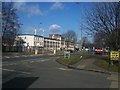
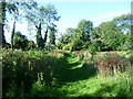
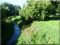
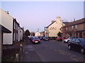


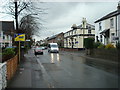

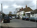
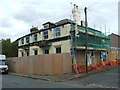
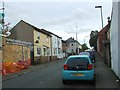
100 photos from this area
Area Information
Key information about the BR5 2DF including its size, population, and administrative classification.
- Area Type
- Postcode
- Area Size
- 9092 m²
- Population
- Not available
- Population Density
- Not available
House Prices in BR5 2DF
25
Properties
£329,888
Average Sold Price
£134,000
Lowest Price
£585,000
Highest Price
Showing 25 properties
| Address | Type | Beds | Baths | Last Sale Price | Last Sale Date | |
|---|---|---|---|---|---|---|
| 39 Marion Crescent, Orpington, BR5 2DF | Detached | 2 | 1 | £462,000 | Aug 2025 | |
| 51 Marion Crescent, Orpington, BR5 2DF | Semi-detached | 3 | 1 | £430,000 | Jun 2024 | |
| 37 Marion Crescent, Orpington, BR5 2DF | Detached | 3 | 2 | £585,000 | Apr 2024 | |
| 47 Marion Crescent, Orpington, BR5 2DF | Semi-detached | 3 | - | £475,000 | May 2023 | |
| 53 Marion Crescent, Orpington, BR5 2DF | Retail | 3 | 2 | £550,000 | Oct 2022 | |
| 45 Marion Crescent, Orpington, BR5 2DF | Bungalow | 3 | 2 | £400,000 | Dec 2020 | |
| 41 Marion Crescent, Orpington, BR5 2DF | Semi-detached | 2 | 1 | £270,000 | Oct 2017 | |
| 29 Marion Crescent, Orpington, BR5 2DF | Detached | 2 | 1 | £265,000 | Jun 2015 | |
| 25 Marion Crescent, Orpington, BR5 2DF | Semi-detached | 2 | 1 | £370,000 | Aug 2014 | |
| 35 Marion Crescent, Orpington, BR5 2DF | house | 2 | - | £228,500 | May 2013 |
Page 1 of 3
Energy Efficiency in BR5 2DF
Amenities
Schools
| Rank | School | Type | Entry gender | Ages |
|---|
Explore more schools in this area
Go to Schools tabDemographics
Household Size
Family (3-5 people)
most common
Accommodation Type
Houses
most common
Tenure
71
majority
Ethnic Group
White
most common
Religion
N/A
most common
Household Composition
N/A
most common
Age
47
median
Adults (30-64 years)
most common
Household Deprivation
N/A
with no deprivation
NS-SEC
38
in Lower managerial occupations
Explore more demographic insights in this area
Go to Demographics tabPlanning
Planning Constraints
- Flood RiskPremium
- Ramsar Wetland SitesPremium
- Area of Outstanding Natural BeautyPremium
- Protected Nature ReservePremium
- Protected WoodlandPremium