Area Overview for BR5 1HJ
Photos of BR5 1HJ
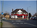
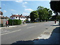
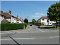
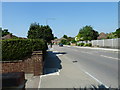

93 photos from this area
Area Information
Key information about the BR5 1HJ including its size, population, and administrative classification.
- Area Type
- Postcode
- Area Size
- 1.0 hectares
- Population
- 1640
- Population Density
- 4780 people/km²
House Prices in BR5 1HJ
23
Properties
£443,586
Average Sold Price
£122,000
Lowest Price
£855,000
Highest Price
Showing 23 properties
| Address | Type | Beds | Baths | Last Sale Price | Last Sale Date | |
|---|---|---|---|---|---|---|
| 41 Crofton Lane, Orpington, BR5 1HJ | Semi-detached | 3 | 1 | £660,000 | Oct 2025 | |
| 53 Crofton Lane, Orpington, BR5 1HJ | Semi-detached | 4 | 2 | £855,000 | Aug 2023 | |
| 65 Crofton Lane, Orpington, BR5 1HJ | house | - | - | £426,000 | Jan 2022 | |
| 55 Crofton Lane, Orpington, BR5 1HJ | Semi-detached | 4 | 2 | £700,000 | Dec 2020 | |
| 67 Crofton Lane, Orpington, BR5 1HJ | Semi-detached | 3 | 1 | £388,000 | Dec 2020 | |
| 53A Crofton Lane, Orpington, BR5 1HJ | Detached | 3 | 2 | £615,000 | Oct 2020 | |
| 71 Crofton Lane, Orpington, BR5 1HJ | Detached | 5 | 2 | £600,000 | Mar 2015 | |
| 59 Crofton Lane, Orpington, BR5 1HJ | house | 3 | - | £285,000 | Apr 2013 | |
| 45 Crofton Lane, Orpington, BR5 1HJ | house | - | - | £412,000 | Jan 2010 | |
| 43 Crofton Lane, Orpington, BR5 1HJ | house | - | - | £395,000 | Aug 2009 |
Page 1 of 3
Energy Efficiency in BR5 1HJ
Amenities
Schools
| Rank | School | Type | Entry gender | Ages |
|---|
Explore more schools in this area
Go to Schools tabDemographics
Household Size
Family (3-5 people)
most common
Accommodation Type
Houses
most common
Tenure
90
majority
Ethnic Group
White
most common
Religion
N/A
most common
Household Composition
N/A
most common
Age
47
median
Adults (30-64 years)
most common
Household Deprivation
N/A
with no deprivation
NS-SEC
49
in Lower managerial occupations
Explore more demographic insights in this area
Go to Demographics tabPlanning
Planning Constraints
- Flood RiskPremium
- Ramsar Wetland SitesPremium
- Area of Outstanding Natural BeautyPremium
- Protected Nature ReservePremium
- Protected WoodlandPremium