Area Overview for BR5 1EG
Photos of BR5 1EG
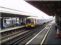
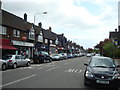
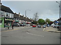

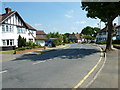
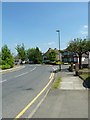
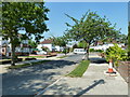
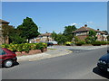
100 photos from this area
Area Information
Key information about the BR5 1EG including its size, population, and administrative classification.
- Area Type
- Postcode
- Area Size
- 2.1 hectares
- Population
- Not available
- Population Density
- Not available
House Prices in BR5 1EG
20
Properties
£449,263
Average Sold Price
£103,000
Lowest Price
£900,000
Highest Price
Showing 20 properties
| Address | Type | Beds | Baths | Last Sale Price | Last Sale Date | |
|---|---|---|---|---|---|---|
| 18 Fairway, Petts Wood, Orpington, BR5 1EG | Semi-detached | 3 | 1 | £820,000 | Nov 2023 | |
| 30 Fairway, Petts Wood, Orpington, BR5 1EG | Semi-detached | 3 | 2 | £900,000 | Oct 2023 | |
| 20 Fairway, Petts Wood, Orpington, BR5 1EG | house | - | - | £750,000 | Jun 2021 | |
| 28 Fairway, Petts Wood, Orpington, BR5 1EG | Semi-detached | 3 | 2 | £715,000 | Mar 2017 | |
| 8 Fairway, Petts Wood, Orpington, BR5 1EG | Semi-detached | 3 | 1 | £525,000 | May 2016 | |
| 10 Fairway, Petts Wood, Orpington, BR5 1EG | Semi-detached | 3 | - | £499,950 | Mar 2014 | |
| 26 Fairway, Petts Wood, Orpington, BR5 1EG | house | - | - | £425,000 | Nov 2013 | |
| 38 Fairway, Petts Wood, Orpington, BR5 1EG | house | - | - | £305,000 | May 2009 | |
| 22 Fairway, Petts Wood, Orpington, BR5 1EG | Semi-detached | - | - | £415,000 | Nov 2007 | |
| 12 Fairway, Petts Wood, Orpington, BR5 1EG | Semi-detached | - | - | £365,000 | Aug 2006 |
Page 1 of 2
Energy Efficiency in BR5 1EG
Amenities
Schools
| Rank | School | Type | Entry gender | Ages |
|---|
Explore more schools in this area
Go to Schools tabDemographics
Household Size
Family (3-5 people)
most common
Accommodation Type
Houses
most common
Tenure
74
majority
Ethnic Group
White
most common
Religion
N/A
most common
Household Composition
N/A
most common
Age
47
median
Adults (30-64 years)
most common
Household Deprivation
N/A
with no deprivation
NS-SEC
49
in Lower managerial occupations
Explore more demographic insights in this area
Go to Demographics tabPlanning
Planning Constraints
- Flood RiskPremium
- Ramsar Wetland SitesPremium
- Area of Outstanding Natural BeautyPremium
- Protected Nature ReservePremium
- Protected WoodlandPremium