Area Overview for BR3 1EF
Photos of BR3 1EF
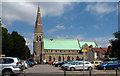
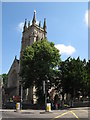
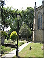

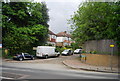
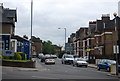
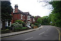
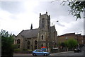
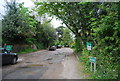
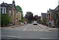
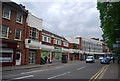
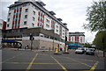
100 photos from this area
Area Information
Key information about the BR3 1EF including its size, population, and administrative classification.
- Area Type
- Postcode
- Area Size
- 1.2 hectares
- Population
- Not available
- Population Density
- Not available
House Prices in BR3 1EF
30
Properties
£606,975
Average Sold Price
£129,950
Lowest Price
£907,000
Highest Price
Showing 30 properties
| Address | Type | Beds | Baths | Last Sale Price | Last Sale Date | |
|---|---|---|---|---|---|---|
| 117 The Drive, Beckenham, BR3 1EF | house | 3 | 1 | £840,000 | Feb 2025 | |
| 101 The Drive, Beckenham, BR3 1EF | house | 3 | 1 | £820,000 | Jul 2024 | |
| 75 The Drive, Beckenham, BR3 1EF | house | 3 | - | £820,000 | May 2024 | |
| 121 The Drive, Beckenham, BR3 1EF | Terraced | 4 | 2 | £907,000 | Jun 2022 | |
| 103 The Drive, Beckenham, BR3 1EF | Terraced | 3 | - | £899,000 | Jan 2022 | |
| 111 The Drive, Beckenham, BR3 1EF | house | 3 | - | £722,500 | May 2021 | |
| 125 The Drive, Beckenham, BR3 1EF | Terraced | 3 | - | £783,000 | May 2021 | |
| 91 The Drive, Beckenham, BR3 1EF | Terraced | 4 | 2 | £795,000 | Mar 2021 | |
| 105 The Drive, Beckenham, BR3 1EF | house | - | - | £735,000 | Oct 2020 | |
| 87 The Drive, Beckenham, BR3 1EF | house | 4 | - | £785,000 | Mar 2020 |
Page 1 of 3
Energy Efficiency in BR3 1EF
Amenities
Schools
| Rank | School | Type | Entry gender | Ages |
|---|
Explore more schools in this area
Go to Schools tabDemographics
Household Size
One person
most common
Accommodation Type
Flats
most common
Tenure
51
majority
Ethnic Group
White
most common
Religion
N/A
most common
Household Composition
N/A
most common
Age
47
median
Adults (30-64 years)
most common
Household Deprivation
N/A
with no deprivation
NS-SEC
51
in Lower managerial occupations
Explore more demographic insights in this area
Go to Demographics tabPlanning
Planning Constraints
- Flood RiskPremium
- Ramsar Wetland SitesPremium
- Area of Outstanding Natural BeautyPremium
- Protected Nature ReservePremium
- Protected WoodlandPremium