Area Overview for BR2 9EA
Photos of BR2 9EA
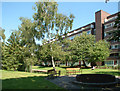
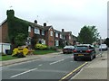
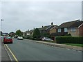
71 photos from this area
Area Information
Key information about the BR2 9EA including its size, population, and administrative classification.
- Area Type
- Postcode
- Area Size
- 28.3 hectares
- Population
- 2222
- Population Density
- 3167 people/km²
House Prices in BR2 9EA
34
Properties
£556,995
Average Sold Price
£250,000
Lowest Price
£990,000
Highest Price
Showing 34 properties
| Address | Type | Beds | Baths | Last Sale Price | Last Sale Date | |
|---|---|---|---|---|---|---|
| 29 Hayes Lane, Hayes, Bromley, BR2 9EA | house | - | - | £555,000 | Oct 2020 | |
| 23 Hayes Lane, Hayes, Bromley, BR2 9EA | house | - | - | £990,000 | Dec 2017 | |
| 25 Hayes Lane, Hayes, Bromley, BR2 9EA | house | - | - | £900,000 | Mar 2016 | |
| 15 Hayes Lane, Hayes, Bromley, BR2 9EA | house | - | - | £662,000 | Jun 2014 | |
| 13 Hayes Lane, Hayes, Bromley, BR2 9EA | Detached | 3 | - | £575,000 | Jan 2014 | |
| 5 Hayes Lane, Hayes, Bromley, BR2 9EA | Detached | 5 | 1 | £550,000 | Apr 2012 | |
| 17 Hayes Lane, Hayes, Bromley, BR2 9EA | house | - | - | £395,000 | Apr 2012 | |
| 21 Hayes Lane, Hayes, Bromley, BR2 9EA | Semi-detached | - | - | £409,950 | Jan 2010 | |
| 7 Hayes Lane, Hayes, Bromley, BR2 9EA | Detached | 4 | 1 | £390,000 | Jul 2009 | |
| 57 Hayes Lane, Hayes, Bromley, BR2 9EA | Detached | 4 | 2 | £450,000 | Aug 2006 |
Page 1 of 4
Energy Efficiency in BR2 9EA
Amenities
Schools
| Rank | School | Type | Entry gender | Ages |
|---|
Explore more schools in this area
Go to Schools tabDemographics
Household Size
Family (3-5 people)
most common
Accommodation Type
Houses
most common
Tenure
66
majority
Ethnic Group
White
most common
Religion
N/A
most common
Household Composition
N/A
most common
Age
47
median
Adults (30-64 years)
most common
Household Deprivation
N/A
with no deprivation
NS-SEC
48
in Lower managerial occupations
Explore more demographic insights in this area
Go to Demographics tabPlanning
Planning Constraints
- Flood RiskPremium
- Ramsar Wetland SitesPremium
- Area of Outstanding Natural BeautyPremium
- Protected Nature ReservePremium
- Protected WoodlandPremium