Area Overview for BR2 8NW
Photos of BR2 8NW
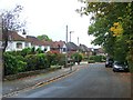
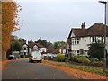
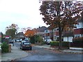
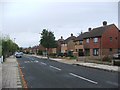
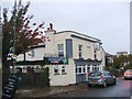
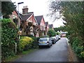
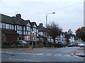
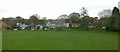
54 photos from this area
Area Information
Key information about the BR2 8NW including its size, population, and administrative classification.
- Area Type
- Postcode
- Area Size
- 8696 m²
- Population
- 1859
- Population Density
- 2230 people/km²
House Prices in BR2 8NW
21
Properties
£343,535
Average Sold Price
£73,000
Lowest Price
£630,000
Highest Price
Showing 21 properties
| Address | Type | Beds | Baths | Last Sale Price | Last Sale Date | |
|---|---|---|---|---|---|---|
| 25 Copthorne Avenue, Bromley, BR2 8NW | house | 3 | 1 | £516,500 | Apr 2022 | |
| 37 Copthorne Avenue, Bromley, BR2 8NW | house | - | - | £550,000 | Jun 2021 | |
| 23 Copthorne Avenue, Bromley, BR2 8NW | Semi-detached | 3 | 1 | £426,000 | Aug 2019 | |
| 29 Copthorne Avenue, Bromley, BR2 8NW | Semi-detached | 3 | 1 | £463,000 | Jul 2018 | |
| Copbarns, 3 Copthorne Avenue, Bromley, BR2 8NW | Detached | 4 | 3 | £630,000 | Jan 2016 | |
| 11 Copthorne Avenue, Bromley, BR2 8NW | Semi-detached | 3 | - | £417,500 | Oct 2015 | |
| 35 Copthorne Avenue, Bromley, BR2 8NW | Semi-detached | - | - | £288,500 | Dec 2007 | |
| 7 Copthorne Avenue, Bromley, BR2 8NW | Semi-detached | - | - | £218,000 | Dec 2005 | |
| 33 Copthorne Avenue, Bromley, BR2 8NW | Semi-detached | - | - | £212,000 | Aug 2005 | |
| 19 Copthorne Avenue, Bromley, BR2 8NW | Semi-detached | - | - | £242,500 | Aug 2005 |
Page 1 of 3
Energy Efficiency in BR2 8NW
Amenities
Schools
| Rank | School | Type | Entry gender | Ages |
|---|
Explore more schools in this area
Go to Schools tabDemographics
Household Size
Family (3-5 people)
most common
Accommodation Type
Houses
most common
Tenure
78
majority
Ethnic Group
White
most common
Religion
N/A
most common
Household Composition
N/A
most common
Age
47
median
Adults (30-64 years)
most common
Household Deprivation
N/A
with no deprivation
NS-SEC
39
in Lower managerial occupations
Explore more demographic insights in this area
Go to Demographics tabPlanning
Planning Constraints
- Flood RiskPremium
- Ramsar Wetland SitesPremium
- Area of Outstanding Natural BeautyPremium
- Protected Nature ReservePremium
- Protected WoodlandPremium