Area Overview for BR2 8EL
Photos of BR2 8EL
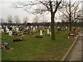
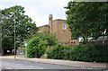
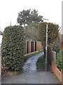
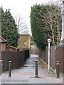
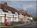
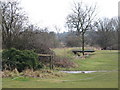
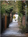
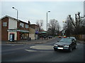
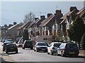
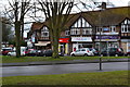
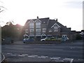
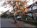
52 photos from this area
Area Information
Key information about the BR2 8EL including its size, population, and administrative classification.
- Area Type
- Postcode
- Area Size
- 1.1 hectares
- Population
- 1803
- Population Density
- 3444 people/km²
House Prices in BR2 8EL
22
Properties
£329,043
Average Sold Price
£137,000
Lowest Price
£547,200
Highest Price
Showing 22 properties
| Address | Type | Beds | Baths | Last Sale Price | Last Sale Date | |
|---|---|---|---|---|---|---|
| 41 Sunray Avenue, Bromley, BR2 8EL | Retail | 3 | 1 | £520,000 | Mar 2022 | |
| 59 Sunray Avenue, Bromley, BR2 8EL | house | - | - | £547,200 | Mar 2021 | |
| 55 Sunray Avenue, Bromley, BR2 8EL | house | - | - | £472,500 | May 2018 | |
| 57 Sunray Avenue, Bromley, BR2 8EL | Semi-detached | 4 | - | £450,000 | Jun 2015 | |
| 67 Sunray Avenue, Bromley, BR2 8EL | Semi-detached | 4 | - | £445,000 | Nov 2014 | |
| 73 Sunray Avenue, Bromley, BR2 8EL | Semi-detached | 3 | - | £400,000 | Aug 2014 | |
| 77 Sunray Avenue, Bromley, BR2 8EL | house | 3 | - | £312,500 | Mar 2012 | |
| 75 Sunray Avenue, Bromley, BR2 8EL | house | - | - | £299,500 | Aug 2011 | |
| 69 Sunray Avenue, Bromley, BR2 8EL | Semi-detached | - | - | £250,000 | Apr 2009 | |
| 47 Sunray Avenue, Bromley, BR2 8EL | Terraced | - | - | £238,000 | Aug 2005 |
Page 1 of 3
Energy Efficiency in BR2 8EL
Amenities
Schools
| Rank | School | Type | Entry gender | Ages |
|---|
Explore more schools in this area
Go to Schools tabDemographics
Household Size
Family (3-5 people)
most common
Accommodation Type
Houses
most common
Tenure
74
majority
Ethnic Group
White
most common
Religion
N/A
most common
Household Composition
N/A
most common
Age
47
median
Adults (30-64 years)
most common
Household Deprivation
N/A
with no deprivation
NS-SEC
37
in Lower managerial occupations
Explore more demographic insights in this area
Go to Demographics tabPlanning
Planning Constraints
- Flood RiskPremium
- Ramsar Wetland SitesPremium
- Area of Outstanding Natural BeautyPremium
- Protected Nature ReservePremium
- Protected WoodlandPremium