Area Overview for BR2 7JD
Photos of BR2 7JD
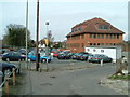
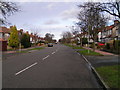
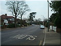
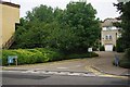
57 photos from this area
Area Information
Key information about the BR2 7JD including its size, population, and administrative classification.
- Area Type
- Postcode
- Area Size
- 1.6 hectares
- Population
- 1631
- Population Density
- 5157 people/km²
House Prices in BR2 7JD
26
Properties
£476,024
Average Sold Price
£141,000
Lowest Price
£800,000
Highest Price
Showing 26 properties
| Address | Type | Beds | Baths | Last Sale Price | Last Sale Date | |
|---|---|---|---|---|---|---|
| 140 Pickhurst Lane, Hayes, Bromley, BR2 7JD | house | - | - | £670,000 | Jun 2022 | |
| 92 Pickhurst Lane, Hayes, Bromley, BR2 7JD | house | - | - | £800,000 | Sep 2021 | |
| 106 Pickhurst Lane, Hayes, Bromley, BR2 7JD | Detached | 3 | 2 | £640,000 | Mar 2020 | |
| 86 Pickhurst Lane, Hayes, Bromley, BR2 7JD | house | - | - | £490,000 | Mar 2019 | |
| 118 Pickhurst Lane, Hayes, Bromley, BR2 7JD | Detached | 3 | 1 | £703,000 | Jun 2018 | |
| 116 Pickhurst Lane, Hayes, Bromley, BR2 7JD | house | - | - | £686,000 | Jul 2017 | |
| 102 Pickhurst Lane, Hayes, Bromley, BR2 7JD | house | - | - | £725,000 | Mar 2016 | |
| 88 Pickhurst Lane, Hayes, Bromley, BR2 7JD | Semi-detached | 5 | 2 | £447,500 | May 2015 | |
| 94 Pickhurst Lane, Hayes, Bromley, BR2 7JD | Detached | 4 | - | £685,000 | Mar 2014 | |
| 114 Pickhurst Lane, Hayes, Bromley, BR2 7JD | Detached | 4 | - | £605,000 | Sep 2013 |
Page 1 of 3
Energy Efficiency in BR2 7JD
Amenities
Schools
| Rank | School | Type | Entry gender | Ages |
|---|
Explore more schools in this area
Go to Schools tabDemographics
Household Size
Family (3-5 people)
most common
Accommodation Type
Houses
most common
Tenure
95
majority
Ethnic Group
White
most common
Religion
N/A
most common
Household Composition
N/A
most common
Age
47
median
Adults (30-64 years)
most common
Household Deprivation
N/A
with no deprivation
NS-SEC
47
in Lower managerial occupations
Explore more demographic insights in this area
Go to Demographics tabPlanning
Planning Constraints
- Flood RiskPremium
- Ramsar Wetland SitesPremium
- Area of Outstanding Natural BeautyPremium
- Protected Nature ReservePremium
- Protected WoodlandPremium