Area Overview for BR2 6DJ
Photos of BR2 6DJ

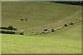
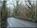
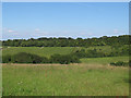
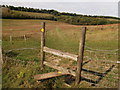
21 photos from this area
Area Information
Key information about the BR2 6DJ including its size, population, and administrative classification.
- Area Type
- Postcode
- Area Size
- 79.2 hectares
- Population
- 2029
- Population Density
- 204 people/km²
House Prices in BR2 6DJ
11
Properties
£1,576,567
Average Sold Price
£675,000
Lowest Price
£4,000,000
Highest Price
Showing 11 properties
| Address | Type | Beds | Baths | Last Sale Price | Last Sale Date | |
|---|---|---|---|---|---|---|
| Bradmoor House, Ashmore Lane, Keston, BR2 6DJ | Detached | 8 | 7 | £4,000,000 | May 2024 | |
| Merlin Cottage, Ashmore Lane, Keston, BR2 6DJ | Cottage | 4 | 3 | £1,325,000 | May 2022 | |
| Whyteleafe Cottage, Ashmore Lane, Keston, BR2 6DJ | Bungalow | 2 | 1 | £675,000 | Nov 2021 | |
| The Coach House, Ashmore Lane, Keston, BR2 6DJ | Detached | 4 | 3 | £900,000 | Jan 2021 | |
| The Ka, Ashmore Lane, Keston, BR2 6DJ | Detached | 4 | - | £982,834 | Feb 2015 | |
| Ashmore, Ashmore Lane, Keston, BR2 6DJ | Bungalow | 8 | 5 | - | - | |
| Caravan, High House Farm, Ashmore Lane, Keston, BR2 6DJ | Mobile Home | - | - | - | - | |
| Millfield, Ashmore Lane, Keston, BR2 6DJ | house | - | - | - | - | |
| The Studio, Bradmoor House, Ashmore Lane, Keston, BR2 6DJ | Bungalow | - | - | - | - | |
| High House Farm, Ashmore Lane, Keston, BR2 6DJ | house | - | - | - | - |
Page 1 of 2
Energy Efficiency in BR2 6DJ
Amenities
Schools
| Rank | School | Type | Entry gender | Ages |
|---|
Explore more schools in this area
Go to Schools tabDemographics
Household Size
Family (3-5 people)
most common
Accommodation Type
Houses
most common
Tenure
79
majority
Ethnic Group
White
most common
Religion
N/A
most common
Household Composition
N/A
most common
Age
47
median
Adults (30-64 years)
most common
Household Deprivation
N/A
with no deprivation
NS-SEC
39
in Lower managerial occupations
Explore more demographic insights in this area
Go to Demographics tabPlanning
Planning Constraints
- Flood RiskPremium
- Ramsar Wetland SitesPremium
- Area of Outstanding Natural BeautyPremium
- Protected Nature ReservePremium
- Protected WoodlandPremium