Area Overview for BR2 6BH
Photos of BR2 6BH
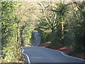
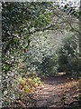
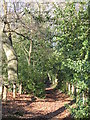
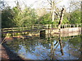
100 photos from this area
Area Information
Key information about the BR2 6BH including its size, population, and administrative classification.
- Area Type
- Postcode
- Area Size
- 1.5 hectares
- Population
- 1891
- Population Density
- 634 people/km²
House Prices in BR2 6BH
20
Properties
£807,364
Average Sold Price
£580,000
Lowest Price
£1,080,000
Highest Price
Showing 20 properties
| Address | Type | Beds | Baths | Last Sale Price | Last Sale Date | |
|---|---|---|---|---|---|---|
| The Hyning, Keston Avenue, Keston, BR2 6BH | Detached | 3 | 1 | £900,000 | Sep 2024 | |
| Holmbury, Keston Avenue, Keston, BR2 6BH | house | - | - | £825,000 | Mar 2021 | |
| Montagu, Keston Avenue, Keston, BR2 6BH | Detached | 4 | 1 | £880,000 | Feb 2020 | |
| Ingleside, Keston Avenue, Keston, BR2 6BH | Retail | 5 | 4 | £856,000 | Jun 2019 | |
| Sandhurst, Keston Avenue, Keston, BR2 6BH | Semi-detached | 4 | - | £850,000 | Dec 2017 | |
| Braemar, Keston Avenue, Keston, BR2 6BH | Semi-detached | 3 | - | £750,000 | Mar 2016 | |
| Kent House, Keston Avenue, Keston, BR2 6BH | Detached | 4 | 3 | £1,080,000 | Jul 2015 | |
| Hursley, Keston Avenue, Keston, BR2 6BH | Bungalow | - | - | £580,000 | Oct 2013 | |
| Corners, Keston Avenue, Keston, BR2 6BH | Detached | 5 | 3 | £600,000 | Oct 2012 | |
| 6 Keston Avenue, Keston, BR2 6BH | house | 4 | - | £850,000 | Jun 2010 |
Page 1 of 2
Energy Efficiency in BR2 6BH
Amenities
Schools
| Rank | School | Type | Entry gender | Ages |
|---|
Explore more schools in this area
Go to Schools tabDemographics
Household Size
Two person
most common
Accommodation Type
Houses
most common
Tenure
88
majority
Ethnic Group
White
most common
Religion
N/A
most common
Household Composition
N/A
most common
Age
47
median
Adults (30-64 years)
most common
Household Deprivation
N/A
with no deprivation
NS-SEC
48
in Lower managerial occupations
Explore more demographic insights in this area
Go to Demographics tabPlanning
Planning Constraints
- Flood RiskPremium
- Ramsar Wetland SitesPremium
- Area of Outstanding Natural BeautyPremium
- Protected Nature ReservePremium
- Protected WoodlandPremium