Area Overview for BR2 6BN
Photos of BR2 6BN
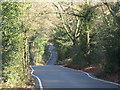
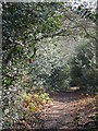
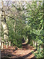
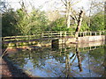
100 photos from this area
Area Information
Key information about the BR2 6BN including its size, population, and administrative classification.
- Area Type
- Postcode
- Area Size
- 5.5 hectares
- Population
- 1891
- Population Density
- 634 people/km²
House Prices in BR2 6BN
52
Properties
£449,488
Average Sold Price
£87,250
Lowest Price
£1,250,000
Highest Price
Showing 52 properties
| Address | Type | Beds | Baths | Last Sale Price | Last Sale Date | |
|---|---|---|---|---|---|---|
| 38 Lakes Road, Keston, BR2 6BN | Terraced | 2 | 1 | £495,000 | Aug 2025 | |
| 30 Lakes Road, Keston, BR2 6BN | Terraced | 3 | 1 | £505,000 | Jul 2025 | |
| 18 Lakes Road, Keston, BR2 6BN | Terraced | 3 | - | £465,000 | Feb 2025 | |
| 20 Lakes Road, Keston, BR2 6BN | Terraced | 3 | 1 | £575,000 | Nov 2024 | |
| 14 Lakes Road, Keston, BR2 6BN | Terraced | 3 | 1 | £482,500 | Jun 2024 | |
| 33 Lakes Road, Keston, BR2 6BN | Terraced | 2 | 1 | £497,000 | Jan 2024 | |
| 34 Lakes Road, Keston, BR2 6BN | Terraced | 2 | 1 | £515,000 | Jul 2023 | |
| 35 Lakes Road, Keston, BR2 6BN | Terraced | 2 | 1 | £485,000 | Mar 2023 | |
| 47 Lakes Road, Keston, BR2 6BN | house | - | - | £1,050,000 | Mar 2023 | |
| 21 Lakes Road, Keston, BR2 6BN | house | 3 | 2 | £535,000 | Aug 2022 |
Page 1 of 6
Energy Efficiency in BR2 6BN
Amenities
Schools
| Rank | School | Type | Entry gender | Ages |
|---|
Explore more schools in this area
Go to Schools tabDemographics
Household Size
Two person
most common
Accommodation Type
Houses
most common
Tenure
88
majority
Ethnic Group
White
most common
Religion
N/A
most common
Household Composition
N/A
most common
Age
47
median
Adults (30-64 years)
most common
Household Deprivation
N/A
with no deprivation
NS-SEC
48
in Lower managerial occupations
Explore more demographic insights in this area
Go to Demographics tabPlanning
Planning Constraints
- Flood RiskPremium
- Ramsar Wetland SitesPremium
- Area of Outstanding Natural BeautyPremium
- Protected Nature ReservePremium
- Protected WoodlandPremium