Area Overview for BR1 3NF
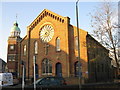
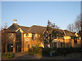
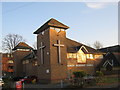
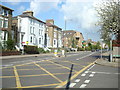
Photos of BR1 3NF


Area Information
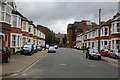
BR1 3NF is a compact residential postcode area in the London Borough of Bromley, England. Covering just 829 square metres, it is densely populated, with 2,033 residents living in a small cluster of flats. This area reflects Bromley’s evolution from a rural village to a suburban commuter hub. Historically, Bromley’s market and railway connections, established in the 19th century, shaped its development as a town serving London’s expanding suburbs. Today, BR1 3NF sits within this legacy, offering proximity to transport links and retail, though its small size means it is best suited for those prioritising convenience over space. The area’s demographics suggest a mature population, with a median age of 47, and a community that leans heavily on rental housing. Living here means navigating a tight-knit, high-density environment with limited expansion potential, but with access to Bromley’s broader amenities just a short distance away.
- Area Type
- Postcode
- Area Size
- 829 m²
- Population
- 2033
- Population Density
- 6120 people/km²
BR1 3NF is characterised by a rental-dominated property market, with only 31% of homes owned by residents. The accommodation type is exclusively flats, which aligns with the area’s small footprint and high density. This suggests a limited housing stock, primarily suited for individuals or couples seeking compact living spaces. The prevalence of flats may also indicate a focus on affordability, as smaller units are typically more cost-effective to purchase or rent. For buyers, this area is unlikely to offer a wide range of properties, and the small size of the postcode means that any available homes are likely to be in close proximity to one another. The low home ownership rate implies a transient population, which could affect the stability of the local real estate market. Prospective buyers should consider the limited scope for expansion or development within this tightly packed area.
House Prices in BR1 3NF
No properties found in this postcode.
Energy Efficiency in BR1 3NF
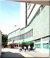
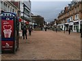
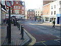
Life in BR1 3NF revolves around its compact network of amenities. Residents have access to five retail stores, including major supermarkets like Sainsburys and Lidl, ensuring everyday shopping needs are met. The area’s transport links, such as Bromley North Station and Beckenham Road Tram Stop, provide easy access to Bromley’s wider retail and leisure offerings. While no parks or recreational spaces are explicitly listed in the data, the proximity to Bromley’s historic market and civic buildings suggests a mix of urban and semi-rural character. The presence of ferry piers and airports indicates a focus on connectivity, though the area’s small size means leisure options are limited to nearby Bromley. Overall, daily life here is defined by convenience and proximity, with a strong emphasis on transport and retail accessibility, albeit within a tightly packed environment.
Amenities
Schools
The only school listed near BR1 3NF is Bromley Mencap, a special school catering to students with specific educational needs. No other schools are mentioned in the data, which means families seeking mainstream primary or secondary education would need to look beyond the immediate area. The presence of a special school highlights the area’s role in supporting specialist educational services, but it does not provide a comprehensive range of school types. Parents with children requiring mainstream schooling may find it necessary to travel to nearby Bromley schools or beyond. The absence of data on school ratings or performance means that further research would be required to assess the quality of education available in the broader Bromley region.
| Rank | School | Type | Entry gender | Ages |
|---|
Explore more schools in this area
Go to Schools tabDemographics
The population of BR1 3NF is 2,033, with a median age of 47, indicating a community skewed towards middle-aged and older residents. The most common age range is 30–64 years, suggesting a stable, working-age population. Home ownership here is low at 31%, meaning the majority of residents are likely to be renters. The accommodation type is predominantly flats, reflecting the area’s compact nature. The predominant ethnic group is White, though specific diversity metrics are not provided. The low home ownership rate may influence the community’s social dynamics, with fewer long-term residents and a higher turnover of tenants. This could affect local cohesion, though the area’s proximity to Bromley’s amenities may offset this. The high population density, at 2.45 million people per square kilometre, underscores the need for efficient use of space and shared resources in daily life.
Household Size
Accommodation Type
Tenure
Ethnic Group
Religion
Household Composition
Age
Household Deprivation
NS-SEC
Explore more demographic insights in this area
Go to Demographics tabPlanning
Planning Constraints
- Flood RiskPremium
- Ramsar Wetland SitesPremium
- Area of Outstanding Natural BeautyPremium
- Protected Nature ReservePremium
- Protected WoodlandPremium