Area Overview for BR1 2UA
Photos of BR1 2UA
Area Information
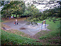
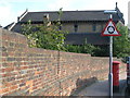
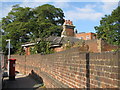
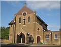
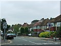
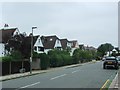
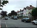
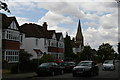
Living in BR1 2UA offers a quiet, residential experience within the Bickley and Sundridge ward of the London Borough of Bromley. This specific postcode cluster covers an area of 3.1 hectares and accommodates 1,541 residents, creating a tight-knit community atmosphere. The location sits approximately 10.4 miles south-east of Charing Cross, positioned between Bromley Town to the west and Chislehurst to the north-east. Historically, the vicinity combines the rich heritage of Sundridge, mentioned in a 987 charter, with Bickley, which developed significantly after Bickley railway station opened in 1858. Today, the estate is defined by large detached housing situated near Jubilee Country Park, a green space spanning 62 acres. Residents here enjoy immediate access to the London LOOP, a network of footpaths and cycle routes that connects local villages with the wider countryside. The area lacks planning constraints such as protected woodlands or Ramsar wetland sites, allowing for straightforward development in some pockets while maintaining its rural character. You can find yourself a short drive from National Trust countryside at Petts Wood and Scadbury Park Nature Reserve, providing excellent opportunities for walking and cycling without leaving your immediate neighbourhood. For those working remotely, the area is serviced by reliable digital infrastructure, ensuring you stay connected despite the suburban setting.
- Area Type
- Postcode
- Area Size
- 3.1 hectares
- Population
- Not available
- Population Density
- Not available
The property market in BR1 2UA is defined by a stable, owner-occupied landscape. With 81% of households owned outright or with a mortgage, this postcode functions primarily as an established residential area rather than a rental hub. The accommodation type is overwhelmingly houses, specifically large detached properties, which is consistent with the broad description of the Bickley and Sundridge districts. This housing structure appeals to buyers seeking spacious living environments rather than urban density or compact flats. For those considering buying or selling a home in this small 3.1-hectare cluster, the market dynamics reflect long-term residency. The high ownership percentage indicates that properties tend to change hands less frequently than in high-density rental zones. Prices likely correlate with the affluent character of the London Borough of Bromley, where large parcels of land are the norm. Prospective buyers should note that the area combines historical significance with modern convenience, potentially supporting sustained demand from families valuing space and heritage. The presence of premium schools and extensive parkland, such as Jubilee Country Park, likely underpins the value of these homes. Selling a property here may take time due to the niche nature of detached housing, but it appeals to those prioritising garden space and privacy.
House Prices in BR1 2UA
Showing 44 properties
| Address | Type | Beds | Baths | Last Sale Price | Last Sale Date | |
|---|---|---|---|---|---|---|
| 14 Edgeborough Way, Bromley, BR1 2UA | Bungalow | 3 | 1 | £600,000 | Mar 2025 | |
| 49 Edgeborough Way, Bromley, BR1 2UA | Bungalow | 2 | 2 | £528,500 | Jun 2024 | |
| 32 Edgeborough Way, Bromley, BR1 2UA | Bungalow | 3 | 2 | £570,000 | Jun 2023 | |
| 9 Edgeborough Way, Bromley, BR1 2UA | Bungalow | - | - | £490,000 | Mar 2022 | |
| 23 Edgeborough Way, Bromley, BR1 2UA | Bungalow | - | - | £520,000 | Nov 2021 | |
| 35 Edgeborough Way, Bromley, BR1 2UA | Bungalow | - | - | £543,750 | Aug 2021 | |
| 18 Edgeborough Way, Bromley, BR1 2UA | Bungalow | 3 | - | £570,000 | Jun 2021 | |
| 21 Edgeborough Way, Bromley, BR1 2UA | Bungalow | - | - | £520,000 | Jun 2021 | |
| 2 Edgeborough Way, Bromley, BR1 2UA | house | - | - | £925,000 | Apr 2021 | |
| 36 Edgeborough Way, Bromley, BR1 2UA | Bungalow | - | - | £485,000 | Oct 2020 |
Energy Efficiency in BR1 2UA
Life in BR1 2UA centres around ample green space and convenient local amenities. You have immediate access to Jubilee Country Park, a vast 62-acre recreational ground that serves as a focal point for leisure and exercise. Beyond the park, the area links to the National Trust countryside at Petts Wood and Scadbury Park Nature Reserve, offering extended walking trails and natural beauty. For daily shopping needs, five retail outlets are within practical reach, including M&S Widmore Bromley BP and two Tesco Bromley stores. These shops provide essentials without requiring a long drive into town. Transport options further enhance your lifestyle convenience, with five rail stations including Sundridge Park and Bromley North, and five metro stops like Beckenham Road and Harrington Road. Five ferry piers, ranging from Greenwich Pier to Barrier Gardens Pier, add flexibility for river crossings or leisurely boating trips. Most residents own 81% of their homes, suggesting a stable community that likely values these local facilities highly. The area also hosts two airports near, specifically Biggin Hill Airport, though this may serve aviation enthusiasts or occasional flyers rather than daily commuters. You will find that living here balances suburban quiet with unexpected convenience, all set within the historic borders of the London Borough of Bromley.
Amenities
Schools
Families living in BR1 2UA benefit from a selection of educational institutions nearby, offering both state and independent pathways for their children. Scotts Park Primary School stands out as the nearest state option, holding a 'good' Ofsted rating. This rating suggests a school that meets high standards of educational quality, providing a solid foundation for local children. For those seeking a different environment, Breaside Preparatory School operates as an independent institution with an 'outstanding' Ofsted rating. This top-tier assessment makes it a prime choice for families prioritising exceptional academic performance and specialised guidance. The existence of two primary schools, Scotts Park and Breaside, alongside preparatory options, offers flexibility for parents. You can choose between the state-funded route with a solid 'good' rating or invest in an independent education with an 'outstanding' reputation. This mix is particularly valuable for residents of the Bickley and Sundridge ward who value education as a central component of their daily lives. The proximity to these institutions minimises travel time to school, allowing more time for family life in the home. Commuters working in London may also appreciate that the drive to these schools starts from a location with direct rail links, ensuring a manageable morning routine regardless of the school chosen.
| Rank | School | Type | Entry gender | Ages |
|---|
Explore more schools in this area
Go to Schools tabDemographics
The community in BR1 2UA is distinctly mature, with a median age of 47 years. The majority of residents fall into the 30 to 64 years age bracket, indicating a family-focused or empty-nester demographic rather than a youthful student population. Such an age profile often correlates with established residents who have put down deep roots in the Bromley borough. Home ownership is a dominant feature of local life, with 81% of homes in this postcode occupied by owners. This high rate suggests a stable community where residents have likely lived for extended periods, fostering a strong sense of local identity and mutual认识. The prevailing accommodation type consists of houses, which aligns with the description of large detached properties found throughout the Bickley and Sundridge districts. This housing stock supports the high ownership rate, as detached homes are traditionally purchased rather than rented. While specific data on deprivation indices is not provided in current records, the high home ownership figure and the presence of luxury amenities suggest a prosperous local economy. The predominant ethnic group in this area is White, reflecting the broader demographic trends often seen in historic suburban Kentish estates. You can expect a neighbourhood where traditions blend with modern suburban comforts, centered around family life and home maintenance rather than transient housing needs.
Household Size
Accommodation Type
Tenure
Ethnic Group
Religion
Household Composition
Age
Household Deprivation
NS-SEC
Explore more demographic insights in this area
Go to Demographics tabPlanning
Planning Constraints
- Flood RiskPremium
- Ramsar Wetland SitesPremium
- Area of Outstanding Natural BeautyPremium
- Protected Nature ReservePremium
- Protected WoodlandPremium