Area Overview for BR1 2PR
Photos of BR1 2PR
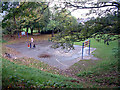
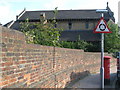
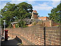
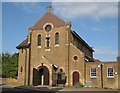
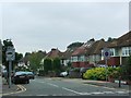
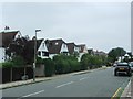
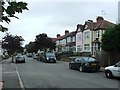
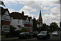
53 photos from this area
Area Information
Key information about the BR1 2PR including its size, population, and administrative classification.
- Area Type
- Postcode
- Area Size
- 5.4 hectares
- Population
- Not available
- Population Density
- Not available
House Prices in BR1 2PR
19
Properties
£645,217
Average Sold Price
£241,000
Lowest Price
£1,435,000
Highest Price
Showing 19 properties
| Address | Type | Beds | Baths | Last Sale Price | Last Sale Date | |
|---|---|---|---|---|---|---|
| Faithlegg, 31 Orchard Road, Bromley, BR1 2PR | Detached | 5 | 3 | £1,060,000 | Jun 2025 | |
| 17 Orchard Road, Bromley, BR1 2PR | Detached | 4 | 2 | £1,435,000 | Jul 2023 | |
| Arcosa, 25A Orchard Road, Bromley, BR1 2PR | house | 5 | - | £850,000 | Feb 2013 | |
| 3 Orchard Road, Bromley, BR1 2PR | house | 4 | - | £670,000 | Dec 2010 | |
| 25 Orchard Road, Bromley, BR1 2PR | Detached | 5 | 4 | £659,950 | May 2003 | |
| 19 Orchard Road, Bromley, BR1 2PR | Detached | - | - | £241,000 | May 1998 | |
| 29 Orchard Road, Bromley, BR1 2PR | Detached | - | - | £300,000 | Jan 1998 | |
| 15 Orchard Road, Bromley, BR1 2PR | house | - | - | £260,000 | Sep 1997 | |
| 13 Orchard Road, Bromley, BR1 2PR | Detached | - | - | £331,000 | Mar 1997 | |
| 31A Orchard Road, Bromley, BR1 2PR | Detached | - | - | - | - |
Page 1 of 2
Energy Efficiency in BR1 2PR
Amenities
Schools
| Rank | School | Type | Entry gender | Ages |
|---|
Explore more schools in this area
Go to Schools tabDemographics
Household Size
Family (3-5 people)
most common
Accommodation Type
Houses
most common
Tenure
81
majority
Ethnic Group
White
most common
Religion
N/A
most common
Household Composition
N/A
most common
Age
47
median
Adults (30-64 years)
most common
Household Deprivation
N/A
with no deprivation
NS-SEC
53
in Lower managerial occupations
Explore more demographic insights in this area
Go to Demographics tabPlanning
Planning Constraints
- Flood RiskPremium
- Ramsar Wetland SitesPremium
- Area of Outstanding Natural BeautyPremium
- Protected Nature ReservePremium
- Protected WoodlandPremium