Area Overview for BR1 2JE
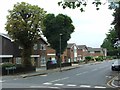
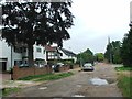
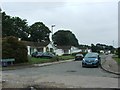
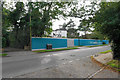
Photos of BR1 2JE
Area Information
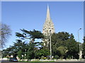
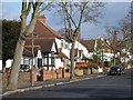
Living in BR1 2JE means residing within a small, specific postcode cluster that sits at the heart of the Bickley and Sundridge electoral ward in the London Borough of Bromley. This area covers just 3689 square metres and houses a population of 1805 people, creating a tightly knit residential environment. The location allows easy access to the wider district while maintaining a focused, village-like feel within Greater London. Historically, the area combines the ancient roots of Sundridge, first recorded in 987, with the rural clearing known as Bickley. Development accelerated after 1858 when the railway station opened, transforming the landscape from forest clearing to a substantial suburb. Today, the neighbourhood is characterised by large detached housing and sits approximately 10.4 miles south-east of Charing Cross. You are bordered by Bromley Town to the west, Chislehurst to the north-east, Petts Wood to the south-east, and Plaistow to the north. As you explore the daily rhythm of life here, you find a setting defined by an absence of planning constraints regarding wetlands, nature reserves, or protected woodlands, ensuring a straightforward residential experience without complex environmental overlays.
- Area Type
- Postcode
- Area Size
- 3689 m²
- Population
- Not available
- Population Density
- Not available
The housing market in BR1 2JE is dominated by owner-occupied stock rather than rental units. With a home ownership rate of 76%, the area functions primarily as a destination for people moving into private homes for the long term. The predominant accommodation type here consists of houses, which aligns with the larger electoral ward's emphasis on detached and semi-detached properties. This high level of ownership suggests a property market focused on capital growth and stability rather than frequent, high-volume turnover. You will find that the housing stock has evolved from the rural clearings of 1279 to substantial family homes, many of which were built to serve the connectivity provided by the Bickley railway station since 1858. Because this is a small residential cluster covering only 3689 square metres, the specific supply of homes is limited, likely keeping competition intense for those seeking properties in this immediate cluster. The market here is not driven by student lets or young professional shared houses but by established families and owners seeking quiet suburban living. Consequently, buyers looking at BR1 2JE should expect to engage with experienced sellers who have been part of this community for decades.
House Prices in BR1 2JE
Showing 4 properties
| Address | Type | Beds | Baths | Last Sale Price | Last Sale Date | |
|---|---|---|---|---|---|---|
| 13 Hurstwood Drive, Bickley, Bromley, BR1 2JE | house | - | - | £962,500 | Dec 2021 | |
| 9 Hurstwood Drive, Bickley, Bromley, BR1 2JE | house | - | - | £530,000 | Aug 2011 | |
| 15 Hurstwood Drive, Bickley, Bromley, BR1 2JE | house | - | - | £500,000 | Aug 2010 | |
| 11 Hurstwood Drive, Bickley, Bromley, BR1 2JE | Detached | - | - | - | - |
Energy Efficiency in BR1 2JE
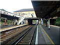
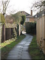
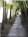
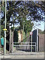
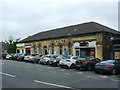
Lifestyle in BR1 2JE is defined by proximity to substantial green spaces and reliable retail options. You have access to several railway hubs, metro tram stops, and retail locations within easy reach. Notable shopping venues include Budgens Southborough, the Co-op Bromley, and Tesco Bromley, all located near the BR1 2JE cluster. For leisure and nature, Jubilee Country Park offers 62 acres of recreation grounds close to the area. Further local amenities include the Beckenham Road Tram Stop, the Avenue Road Tram Stop, and the Fieldway Tram Stop. Residents also benefit from links to National Trust countryside at Petts Wood and Scadbury Park Nature Reserve, providing extensive walking and cycling routes. The area is situated near Biggin Hill Airport, adding a unique dimension to the local transport network. You can enjoy the London LOOP cycle routes and footpaths that weave through the character of the district. This mix of large retail outlets, expansive parks, and historic transport nodes ensures that daily needs are met without long journeys. The presence of five nearby railway stations and multiple tram stops further enhances your ability to travel quickly if you choose to venture beyond the immediate residential cluster.
Amenities
Schools
| Rank | School | Type | Entry gender | Ages |
|---|
Explore more schools in this area
Go to Schools tabDemographics
The community in BR1 2JE reflects a mature and established neighbourhood. The median age stands at 47 years, indicating that Adults aged between 30 and 64 constitute the most common age range. This demographic profile suggests a population seeking stability and long-term residence rather than transient living. Home ownership is exceptionally high, with 76% of residents owning their properties outright or with a mortgage. This figure confirms the area's status as a permanent home base for families and retirees rather than a commuter belt for rental tenants. The predominant ethnic group is White, aligning with the traditional suburban character of the district. You will find that the local crowd consists largely of owners of houses, which is consistent with the high percentage of detached dwellings and the overall wealth profile of the ward created in 2022. This high level of tenure stability fosters a neighbourhood where residents invest in their properties and local infrastructure, creating a predictable and secure environment for those considering homes in BR1 2JE.
Household Size
Accommodation Type
Tenure
Ethnic Group
Religion
Household Composition
Age
Household Deprivation
NS-SEC
Explore more demographic insights in this area
Go to Demographics tabPlanning
Planning Constraints
- Flood RiskPremium
- Ramsar Wetland SitesPremium
- Area of Outstanding Natural BeautyPremium
- Protected Nature ReservePremium
- Protected WoodlandPremium