Area Overview for WD19 4TS
Photos of WD19 4TS
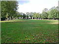
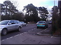
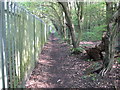
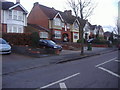
14 photos from this area
Area Information
Key information about the WD19 4TS including its size, population, and administrative classification.
- Area Type
- Postcode
- Area Size
- 7931 m²
- Population
- 1773
- Population Density
- 4175 people/km²
House Prices in WD19 4TS
9
Properties
£770,143
Average Sold Price
£150,000
Lowest Price
£1,550,000
Highest Price
Showing 9 properties
| Address | Type | Beds | Baths | Last Sale Price | Last Sale Date | |
|---|---|---|---|---|---|---|
| 60 Woodwaye, Watford, WD19 4TS | Detached | 5 | 2 | £1,039,000 | May 2023 | |
| 62 Woodwaye, Watford, WD19 4TS | Detached | 4 | 2 | £1,200,000 | Jun 2022 | |
| 58 Woodwaye, Watford, WD19 4TS | Detached | 8 | 4 | £1,550,000 | Jan 2021 | |
| 56 Woodwaye, Watford, WD19 4TS | Detached | 4 | 2 | £925,000 | Sep 2019 | |
| 64 Woodwaye, Watford, WD19 4TS | Bungalow | 3 | 2 | £323,000 | Nov 2005 | |
| 66 Woodwaye, Oxhey Hall, WD19 4TS | Detached | - | - | £204,000 | Jan 1997 | |
| 50 Woodwaye, Watford, WD19 4TS | Terraced | - | - | £150,000 | Mar 1996 | |
| 52 Woodwaye, Watford, WD19 4TS | Detached | 4 | 1 | - | - | |
| 54 Woodwaye, Watford, WD19 4TS | house | - | - | - | - |
Energy Efficiency in WD19 4TS
Amenities
Schools
| Rank | School | Type | Entry gender | Ages |
|---|
Explore more schools in this area
Go to Schools tabDemographics
Household Size
Family (3-5 people)
most common
Accommodation Type
Houses
most common
Tenure
80
majority
Ethnic Group
White
most common
Religion
N/A
most common
Household Composition
N/A
most common
Age
47
median
Adults (30-64 years)
most common
Household Deprivation
N/A
with no deprivation
NS-SEC
50
in Lower managerial occupations
Explore more demographic insights in this area
Go to Demographics tabPlanning
Planning Constraints
- Flood RiskPremium
- Ramsar Wetland SitesPremium
- Area of Outstanding Natural BeautyPremium
- Protected Nature ReservePremium
- Protected WoodlandPremium