Area Overview for WD19 4NN
Photos of WD19 4NN

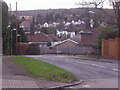
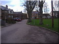

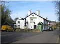
14 photos from this area
Area Information
Key information about the WD19 4NN including its size, population, and administrative classification.
- Area Type
- Postcode
- Area Size
- 2.4 hectares
- Population
- 1773
- Population Density
- 4175 people/km²
House Prices in WD19 4NN
30
Properties
£488,203
Average Sold Price
£185,000
Lowest Price
£938,000
Highest Price
Showing 30 properties
| Address | Type | Beds | Baths | Last Sale Price | Last Sale Date | |
|---|---|---|---|---|---|---|
| 31 Woodwaye, Watford, WD19 4NN | house | 5 | 2 | £938,000 | Apr 2023 | |
| 21 Woodwaye, Watford, WD19 4NN | house | 4 | - | £739,950 | Mar 2018 | |
| 41 Woodwaye, Watford, WD19 4NN | house | - | - | £750,000 | Mar 2017 | |
| 3 Woodwaye, Watford, WD19 4NN | house | - | - | £460,000 | Apr 2012 | |
| 43 Woodwaye, Watford, WD19 4NN | house | - | - | £515,000 | Aug 2011 | |
| 37 Woodwaye, Watford, WD19 4NN | house | - | - | £545,000 | Apr 2010 | |
| 53 Woodwaye, Watford, WD19 4NN | Detached | - | - | £340,000 | Aug 2009 | |
| 17 Woodwaye, Watford, WD19 4NN | Terraced | - | - | £660,000 | Jun 2008 | |
| 35 Woodwaye, Watford, WD19 4NN | Detached | 4 | 2 | £539,500 | Jul 2004 | |
| 25 Woodwaye, Watford, WD19 4NN | Terraced | - | - | £637,000 | Jul 2003 |
Page 1 of 3
Energy Efficiency in WD19 4NN
Amenities
Schools
| Rank | School | Type | Entry gender | Ages |
|---|
Explore more schools in this area
Go to Schools tabDemographics
Household Size
Family (3-5 people)
most common
Accommodation Type
Houses
most common
Tenure
80
majority
Ethnic Group
White
most common
Religion
N/A
most common
Household Composition
N/A
most common
Age
47
median
Adults (30-64 years)
most common
Household Deprivation
N/A
with no deprivation
NS-SEC
50
in Lower managerial occupations
Explore more demographic insights in this area
Go to Demographics tabPlanning
Planning Constraints
- Flood RiskPremium
- Ramsar Wetland SitesPremium
- Area of Outstanding Natural BeautyPremium
- Protected Nature ReservePremium
- Protected WoodlandPremium