Area Overview for WD18 7HN
Photos of WD18 7HN

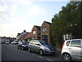
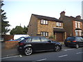
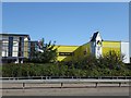
52 photos from this area
Area Information
Key information about the WD18 7HN including its size, population, and administrative classification.
- Area Type
- Postcode
- Area Size
- 2331 m²
- Population
- 1833
- Population Density
- 14343 people/km²
House Prices in WD18 7HN
41
Properties
£135,667
Average Sold Price
£52,800
Lowest Price
£223,000
Highest Price
Showing 41 properties
| Address | Type | Beds | Baths | Last Sale Price | Last Sale Date | |
|---|---|---|---|---|---|---|
| 23, Copperdale Court, The Gateway, Watford, WD18 7HN | Flat | 1 | 1 | £223,000 | Dec 2024 | |
| 40, Copperdale Court, The Gateway, Watford, WD18 7HN | Flat | - | - | £212,500 | Aug 2023 | |
| 24, Copperdale Court, The Gateway, Watford, WD18 7HN | Flat | - | - | £126,000 | Oct 2022 | |
| 34, Copperdale Court, The Gateway, Watford, WD18 7HN | Flat | 1 | 1 | £205,000 | Aug 2022 | |
| 36, Copperdale Court, The Gateway, Watford, WD18 7HN | Flat | - | - | £99,000 | Nov 2021 | |
| 25, Copperdale Court, The Gateway, Watford, WD18 7HN | Flat | - | - | £112,200 | Dec 2017 | |
| 22, Copperdale Court, The Gateway, Watford, WD18 7HN | Flat | 1 | 1 | £108,000 | Sep 2016 | |
| 26, Copperdale Court, The Gateway, Watford, WD18 7HN | Flat | - | - | £82,500 | Feb 2016 | |
| 41, Copperdale Court, The Gateway, Watford, WD18 7HN | Flat | 1 | 1 | £52,800 | Feb 2013 | |
| 10, Copperdale Court, The Gateway, Watford, WD18 7HN | Flat | 1 | 1 | - | - |
Page 1 of 5
Energy Efficiency in WD18 7HN
Amenities
Schools
| Rank | School | Type | Entry gender | Ages |
|---|
Explore more schools in this area
Go to Schools tabDemographics
Household Size
Family (3-5 people)
most common
Accommodation Type
Flats
most common
Tenure
35
majority
Ethnic Group
White
most common
Religion
N/A
most common
Household Composition
N/A
most common
Age
47
median
Adults (30-64 years)
most common
Household Deprivation
N/A
with no deprivation
NS-SEC
33
in Lower managerial occupations
Explore more demographic insights in this area
Go to Demographics tabPlanning
Planning Constraints
- Flood RiskPremium
- Ramsar Wetland SitesPremium
- Area of Outstanding Natural BeautyPremium
- Protected Nature ReservePremium
- Protected WoodlandPremium