Area Overview for WD18 6NU
Photos of WD18 6NU
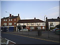
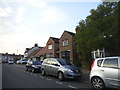
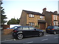
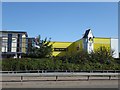
52 photos from this area
Area Information
Key information about the WD18 6NU including its size, population, and administrative classification.
- Area Type
- Postcode
- Area Size
- 1.7 hectares
- Population
- 1735
- Population Density
- 4592 people/km²
House Prices in WD18 6NU
24
Properties
£328,333
Average Sold Price
£80,000
Lowest Price
£465,000
Highest Price
Showing 24 properties
| Address | Type | Beds | Baths | Last Sale Price | Last Sale Date | |
|---|---|---|---|---|---|---|
| 60 Tolpits Lane, Watford, WD18 6NU | house | - | - | £465,000 | Jun 2021 | |
| 82 Tolpits Lane, Watford, WD18 6NU | Terraced | 3 | 1 | £455,000 | Aug 2020 | |
| 66 Tolpits Lane, Watford, WD18 6NU | house | - | - | £440,000 | Aug 2020 | |
| 70 Tolpits Lane, Watford, WD18 6NU | house | - | - | £390,000 | Feb 2019 | |
| 94 Tolpits Lane, Watford, WD18 6NU | house | 4 | 3 | £420,000 | Nov 2017 | |
| 68 Tolpits Lane, Watford, WD18 6NU | house | - | - | £250,000 | Mar 2013 | |
| 62 Tolpits Lane, Watford, WD18 6NU | house | 3 | - | £235,000 | Jun 2010 | |
| 80 Tolpits Lane, Watford, WD18 6NU | house | - | - | £220,000 | Feb 2010 | |
| 90 Tolpits Lane, Watford, WD18 6NU | Terraced | - | - | £80,000 | May 1998 | |
| 92 Tolpits Lane, Watford, WD18 6NU | Terraced | - | - | - | - |
Page 1 of 3
Energy Efficiency in WD18 6NU
Amenities
Schools
| Rank | School | Type | Entry gender | Ages |
|---|
Explore more schools in this area
Go to Schools tabDemographics
Household Size
Family (3-5 people)
most common
Accommodation Type
Flats
most common
Tenure
40
majority
Ethnic Group
White
most common
Religion
N/A
most common
Household Composition
N/A
most common
Age
47
median
Adults (30-64 years)
most common
Household Deprivation
N/A
with no deprivation
NS-SEC
30
in Lower managerial occupations
Explore more demographic insights in this area
Go to Demographics tabPlanning
Planning Constraints
- Flood RiskPremium
- Ramsar Wetland SitesPremium
- Area of Outstanding Natural BeautyPremium
- Protected Nature ReservePremium
- Protected WoodlandPremium