Area Overview for WD18 0HL
Photos of WD18 0HL

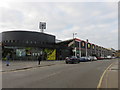

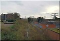
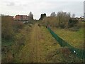
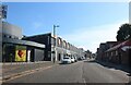

41 photos from this area
Area Information
Key information about the WD18 0HL including its size, population, and administrative classification.
- Area Type
- Postcode
- Area Size
- 3166 m²
- Population
- 1670
- Population Density
- 17378 people/km²
House Prices in WD18 0HL
6
Properties
£221,200
Average Sold Price
£98,000
Lowest Price
£325,000
Highest Price
Showing 6 properties
| Address | Type | Beds | Baths | Last Sale Price | Last Sale Date | |
|---|---|---|---|---|---|---|
| 98C Hagden Lane, Watford, WD18 0HL | house | - | - | £225,000 | Jun 2023 | |
| 98B Hagden Lane, Watford, WD18 0HL | Maisonette | 2 | 1 | £310,000 | Mar 2023 | |
| 98A Hagden Lane, Watford, WD18 0HL | Flat | 2 | 1 | £325,000 | Oct 2022 | |
| 94 Hagden Lane, Watford, WD18 0HL | Terraced | 1 | 1 | £148,000 | Dec 2000 | |
| 96 Hagden Lane, Watford, WD18 0HL | house | - | - | £98,000 | May 1997 | |
| 92 Hagden Lane, Watford, WD18 0HL | Terraced | - | - | - | - |
Energy Efficiency in WD18 0HL
Amenities
Schools
| Rank | School | Type | Entry gender | Ages |
|---|
Explore more schools in this area
Go to Schools tabDemographics
Household Size
Family (3-5 people)
most common
Accommodation Type
Houses
most common
Tenure
51
majority
Ethnic Group
asian_total
most common
Religion
N/A
most common
Household Composition
N/A
most common
Age
47
median
Adults (30-64 years)
most common
Household Deprivation
N/A
with no deprivation
NS-SEC
27
in Lower managerial occupations
Explore more demographic insights in this area
Go to Demographics tabPlanning
Planning Constraints
- Flood RiskPremium
- Ramsar Wetland SitesPremium
- Area of Outstanding Natural BeautyPremium
- Protected Nature ReservePremium
- Protected WoodlandPremium