Area Overview for Sudbury
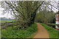
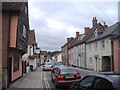
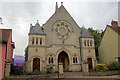
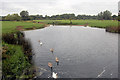
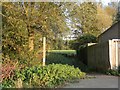
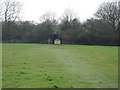
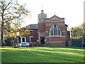
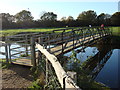
Photos of Sudbury


Area Information
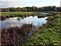
Sudbury stands as a distinct civil parish on the edge of popular Suffolk and the border with Essex. You can find the town located on the River Stour, situated near coordinates approximately 52.046409, 0.732461. This market town covers a compact area of 7.9 square kilometres, resulting in a population density of 622 people per square kilometre. The community counts 4,926 residents who call this space home. Historically, the area was established as a market town around 1009, with records first mentioning it near 970. Simon Sudbury, after whom the town is named, was born into this setting following the construction of the Church of All Saints in the 12th century. The River Stour became navigable in 1706, facilitating the trade that once drove the local economy through wool and silk. Today, this historical backdrop supports daily life for families and individuals. Living in Sudbury offers access to the Church of All Saints and Thomas Gainsborough's birthplace museum. The layout remains small enough to feel connected yet retains its independent character. This specific postcode area, CO10 1AD, continues to serve as a gateway to the broader county. You navigate distance by road networks like the A134 and proximity to the A12. With its manageable size and deep roots, Sudbury provides a setting where history and modern living intersect without the sprawl of larger cities.
- Area Type
- Parish
- Area Size
- 7.9 km²
- Population
- 4926
- Population Density
- 622 people/km²
Demographics
You must understand the age profile of Sudbury before considering life here. The median age for the population sits at 70 years, a figure that distinguishes this community from younger urban centres. This demographic weight indicates a retirement or later-life settlement pattern. Standard age breakdowns show total population distribution rather than segmented youth or young adult figures. Home ownership is a defining feature of this parish. Approximately 63 per cent of residents own their homes outright or with a mortgage. This ownership rate suggests financial stability and long-term commitment to the area within this civil parish. Accommodation types reflect the historical development of the town, though specific breakdowns into flats versus houses are aggregated under total data. The community composition remains largely consistent with the total population figures available. You do not find extensive data on predominant ethnic groups or specific religious affiliations in the current records. Deprivation indicators are absent from the dataset, meaning you cannot calculate income gaps or poverty levels from the source material. The lack of detailed household composition data means you must rely on the broad age and ownership statistics. A 63 per cent ownership rate confirms that most people living in Sudbury are settled residents rather than transient tenants. The high median age combined with strong home ownership paints a picture of a stable, established neighbourhood.
Household Size
Accommodation Type
Tenure
Ethnic Group
Religion
Household Composition
Age
Household Deprivation
NS-SEC
Explore more demographic insights in this area
Go to Demographics tabPlanning
Planning Constraints
- Flood RiskPremium
- Ramsar Wetland SitesPremium
- Area of Outstanding Natural BeautyPremium
- Protected Nature ReservePremium
- Protected WoodlandPremium
- Crime RiskPremium