Area Overview for Babergh District
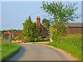
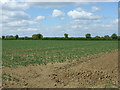
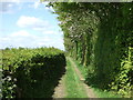
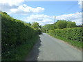
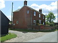
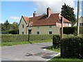
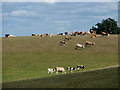
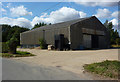
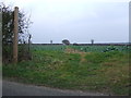
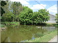
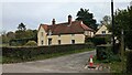
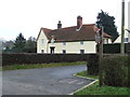
Photos of Babergh District
Area Information
Living in Babergh District offers a distinctly rural experience within the wider county of Suffolk. This unitary authority covers a vast expanse of 611.3 km², providing a large geographical buffer between your home and the nearest bustling city centre. You will find yourself immersed in a landscape dominated by countryside rather than urban sprawl. The area functions as a local authority district where daily life revolves closely around nature and local villages instead of high-rise developments or heavy traffic. Your routine will likely involve travelling further distances for major commercial centres compared to dense urban boroughs. The sheer size of Babergh District means amenities and services are often clustered in specific towns rather than being omnipresent. You will experience a slower pace of life that prioritises wide-open spaces over city quarters. This environment suits those who value privacy and open skies over the immediate convenience of district centres. There is a strong emphasis on preserving the natural environment, which influences local planning and community life. When you consider homes in Babergh District, you are entering a specific type of market defined by its vast footprint and quiet residential nature. The district administrative structure as a unitary authority means you deal with a single level of government for local services, simplifying certain bureaucratic interactions. However, the rural character means you must accept longer commute times for work in major employment hubs. Your property search should account for the significant land area that defines this region. The sense of place here is rooted in its status as a large, undivided district rather than a compact town council area. Your move to Babergh District will place you in a setting where the countryside is your immediate neighbour. This area is not designed for impulsive shopping trips or quick social visits to distant locations. Instead, it fosters a lifestyle where the community extends over many kilometres of road and field. You must be prepared for this geographical reality when evaluating your potential new home.
- Area Type
- District/Borough
- Area Size
- 611.3 km²
- Population
- Not available
- Population Density
- Not available
Demographics
The community living in Babergh District reflects a mature and settled population. The median age stands at 70 years, indicating that the majority of residents are seniors or older adults. This demographic profile suggests a community that has aged in place over many decades rather than attracting young professionals or families seeking rapid growth. When you look at the age structure, the data confirms that the population is heavily weighted towards the later stages of life. This is evident in the most common age range category, which aligns with the high median figure. Home ownership in Babergh District reaches 72 per cent of all households. This high rate indicates that residents have typically owned their properties for extended periods, contributing to the stability of the local community. You will find it difficult to rent accommodation as a long-term tenant because most housing stock is privately owned by the people who live there. The high proportion of owner-occupied homes often results in slower property turnover rates. The household composition in Babergh District tends to reflect the older age profile, with many homes likely housing single individuals or couples with established property histories. While specific breakdowns of household types are not detailed beyond the total category, the data points clearly towards a non-transient population. The area does not show evidence of the rapid demographic shifts seen in growth corridors or university towns. Your neighbours will likely have deep local roots and a long-standing connection to their villages. The social fabric of Babergh District is shaped by this demographic consistency. You can expect a society that has evolved slowly rather than one driven by new migration patterns. The high home ownership rate further cements this picture of a community where residents stay put. When you consider who lives here, you are looking at a population that cherishes its established status and resists external influences that might alter its character too quickly.
Household Size
Accommodation Type
Tenure
Ethnic Group
Religion
Household Composition
Age
Household Deprivation
NS-SEC
Explore more demographic insights in this area
Go to Demographics tabPlanning
Planning Constraints
- Flood RiskPremium
- Ramsar Wetland SitesPremium
- Area of Outstanding Natural BeautyPremium
- Protected Nature ReservePremium
- Protected WoodlandPremium