Area Overview for Mid Suffolk District
Photos of Mid Suffolk District


Area Information
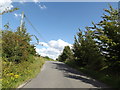
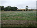
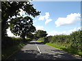
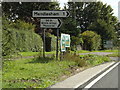
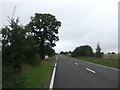
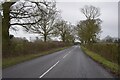
Living in Mid Suffolk District offers a distinct experience set within a local authority district spanning 870.8 square kilometres. The sheer scale of this area defines daily life, separating it from smaller, more compact towns. You will find yourself in an environment where distance plays a significant role in accessing services and commuting. The character of the region is shaped by this vast footprint, creating a landscape where neighbours may be miles apart yet share the same local governance. Prospective buyers looking for space and a slower pace must consider how you will navigate such a large territory. This is not a walkable neighbourhood in the traditional sense; rather, it is a district where the distance between your home and the next village can vary significantly. Understanding the geography is essential before viewing homes in Mid Suffolk District. The area's size influences everything from emergency response times to the availability of local amenities within a short drive. You need to be prepared for a lifestyle where self-reliance and planned travel are central to your routine. The district provides a wide canvas, but it lacks the density found in urban centres. Those drawn to this location recognise the trade-off between open land and immediate convenience.
- Area Type
- District/Borough
- Area Size
- 870.8 km²
- Population
- Not available
- Population Density
- Not available
Demographics
The community in Mid Suffolk District is defined by a notably mature population structure. Data indicates a median age of 70 years, meaning half the population is older than this threshold. This demographic profile suggests that the most common age group consists of older residents, influencing the local demand for specific services and housing styles. It is an older neighbourhood where life expectancy and retirement play a major role in social dynamics. Home ownership stands at the highest level recorded in the local area statistics, with 75% of residents owning their property. This high figure confirms that Mid Suffolk District is primarily an owner-occupied zone rather than a letting market. The accommodation types and household composition reflect this stability, with long-term residents forming the backbone of the community. You do not need to look for trendy amenities catering to young professionals, as the social fabric is built around established families and retirees. The lack of significant youth populations is a defining feature of the area. When viewing homes in Mid Suffolk District, you are joining a settled community with deep local roots. The demographic data paints a clear picture of a quiet, established region where the majority of the population has likely lived in their homes for decades.
Household Size
Accommodation Type
Tenure
Ethnic Group
Religion
Household Composition
Age
Household Deprivation
NS-SEC
Explore more demographic insights in this area
Go to Demographics tabPlanning
Planning Constraints
- Flood RiskPremium
- Area of Outstanding Natural BeautyPremium
- Protected WoodlandPremium