Area Overview for SS9 1HE
Photos of SS9 1HE
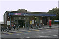
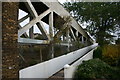
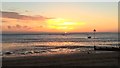
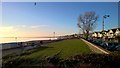
89 photos from this area
Area Information
Key information about the SS9 1HE including its size, population, and administrative classification.
- Area Type
- Postcode
- Area Size
- 8480 m²
- Population
- 1557
- Population Density
- 4534 people/km²
House Prices in SS9 1HE
22
Properties
£558,530
Average Sold Price
£128,600
Lowest Price
£899,950
Highest Price
Showing 22 properties
| Address | Type | Beds | Baths | Last Sale Price | Last Sale Date | |
|---|---|---|---|---|---|---|
| 11 Kent View Avenue, Leigh On Sea, SS9 1HE | Semi-detached | 4 | 1 | £750,000 | Jun 2025 | |
| 8 Kent View Avenue, Leigh On Sea, SS9 1HE | Semi-detached | 3 | 1 | £740,000 | Mar 2025 | |
| 24 Kent View Avenue, Leigh On Sea, SS9 1HE | house | - | - | £885,000 | Jun 2023 | |
| 26 Kent View Avenue, Leigh On Sea, SS9 1HE | house | - | - | £830,000 | Oct 2021 | |
| 18 Kent View Avenue, Leigh On Sea, SS9 1HE | Flat | - | - | £285,000 | Dec 2016 | |
| 27 Kent View Avenue, Leigh On Sea, SS9 1HE | Semi-detached | 4 | 2 | £690,000 | Sep 2016 | |
| 17 Kent View Avenue, Leigh On Sea, SS9 1HE | Semi-detached | 4 | - | £738,000 | May 2016 | |
| 20 Kent View Avenue, Leigh On Sea, SS9 1HE | Detached | 4 | 2 | £899,950 | May 2016 | |
| 25 Kent View Avenue, Leigh On Sea, SS9 1HE | Semi-detached | 4 | 2 | £645,000 | Apr 2016 | |
| 9 Kent View Avenue, Leigh On Sea, SS9 1HE | Semi-detached | 4 | 1 | £500,000 | Sep 2014 |
Page 1 of 3
Energy Efficiency in SS9 1HE
Amenities
Schools
| Rank | School | Type | Entry gender | Ages |
|---|
Explore more schools in this area
Go to Schools tabDemographics
Household Size
Family (3-5 people)
most common
Accommodation Type
Houses
most common
Tenure
83
majority
Ethnic Group
White
most common
Religion
N/A
most common
Household Composition
N/A
most common
Age
47
median
Adults (30-64 years)
most common
Household Deprivation
N/A
with no deprivation
NS-SEC
54
in Lower managerial occupations
Explore more demographic insights in this area
Go to Demographics tabPlanning
Planning Constraints
- Flood RiskPremium
- Ramsar Wetland SitesPremium
- Area of Outstanding Natural BeautyPremium
- Protected Nature ReservePremium
- Protected WoodlandPremium