Area Overview for SS5 6JZ
Photos of SS5 6JZ

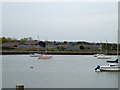
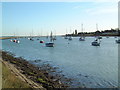
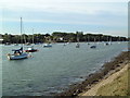
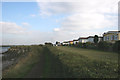
51 photos from this area
Area Information
Key information about the SS5 6JZ including its size, population, and administrative classification.
- Area Type
- Postcode
- Area Size
- 1.7 hectares
- Population
- 1652
- Population Density
- 400 people/km²
House Prices in SS5 6JZ
23
Properties
£328,208
Average Sold Price
£59,000
Lowest Price
£1,200,000
Highest Price
Showing 23 properties
| Address | Type | Beds | Baths | Last Sale Price | Last Sale Date | |
|---|---|---|---|---|---|---|
| 176 Ferry Road, Hullbridge, SS5 6JZ | Semi-detached | 2 | - | £310,000 | Nov 2023 | |
| 204 Ferry Road, Hullbridge, SS5 6JZ | Bungalow | - | - | £311,000 | Sep 2021 | |
| 172 Ferry Road, Hullbridge, SS5 6JZ | Bungalow | - | - | £1,200,000 | Apr 2021 | |
| 190 Ferry Road, Hullbridge, SS5 6JZ | Semi-detached | 4 | - | £337,500 | May 2020 | |
| 186 Ferry Road, Hullbridge, SS5 6JZ | Detached | 3 | 1 | £387,000 | Jul 2018 | |
| 170 Ferry Road, Hullbridge, SS5 6JZ | Semi-detached | 4 | - | £310,000 | May 2016 | |
| 164 Ferry Road, Hullbridge, SS5 6JZ | Bungalow | 3 | - | £225,000 | Apr 2014 | |
| 196 Ferry Road, Hullbridge, SS5 6JZ | Bungalow | - | - | £225,000 | Feb 2013 | |
| 174 Ferry Road, Hullbridge, SS5 6JZ | Semi-detached | 2 | 1 | £200,000 | Oct 2011 | |
| 194 Ferry Road, Hullbridge, SS5 6JZ | Semi-detached | - | - | £184,000 | Apr 2006 |
Page 1 of 3
Energy Efficiency in SS5 6JZ
Amenities
Schools
| Rank | School | Type | Entry gender | Ages |
|---|
Explore more schools in this area
Go to Schools tabDemographics
Household Size
One person
most common
Accommodation Type
Other
most common
Tenure
89
majority
Ethnic Group
White
most common
Religion
N/A
most common
Household Composition
N/A
most common
Age
47
median
Elderly (65+ years)
most common
Household Deprivation
N/A
with no deprivation
NS-SEC
24
in Lower managerial occupations
Explore more demographic insights in this area
Go to Demographics tabPlanning
Planning Constraints
- Flood RiskPremium
- Ramsar Wetland SitesPremium
- Area of Outstanding Natural BeautyPremium
- Protected Nature ReservePremium
- Protected WoodlandPremium