Area Overview for SS5 4SQ
Photos of SS5 4SQ
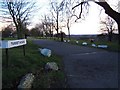
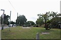
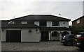
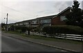

16 photos from this area
Area Information
Key information about the SS5 4SQ including its size, population, and administrative classification.
- Area Type
- Postcode
- Area Size
- 9462 m²
- Population
- 2316
- Population Density
- 510 people/km²
House Prices in SS5 4SQ
20
Properties
£335,208
Average Sold Price
£157,500
Lowest Price
£530,000
Highest Price
Showing 20 properties
| Address | Type | Beds | Baths | Last Sale Price | Last Sale Date | |
|---|---|---|---|---|---|---|
| 43 Laburnum Grove, Hockley, SS5 4SQ | Bungalow | 3 | 2 | £415,000 | Sep 2025 | |
| 1 Laburnum Grove, Hockley, SS5 4SQ | Semi-detached | 4 | 2 | £410,000 | Mar 2025 | |
| 23 Laburnum Grove, Hockley, SS5 4SQ | Semi-detached | 3 | - | £350,000 | Oct 2020 | |
| 3 Laburnum Grove, Hockley, SS5 4SQ | Semi-detached | 3 | 1 | £350,000 | Sep 2020 | |
| 11 Laburnum Grove, Hockley, SS5 4SQ | Semi-detached | 3 | - | £370,000 | Sep 2019 | |
| 9 Laburnum Grove, Hockley, SS5 4SQ | Semi-detached | 3 | 2 | £375,000 | Mar 2019 | |
| 21 Laburnum Grove, Hockley, SS5 4SQ | house | - | - | £530,000 | Feb 2017 | |
| 21A Laburnum Grove, Hockley, SS5 4SQ | house | - | - | £350,000 | Apr 2015 | |
| 37 Laburnum Grove, Hockley, SS5 4SQ | Detached | 4 | 3 | £275,000 | Mar 2014 | |
| 15 Laburnum Grove, Hockley, SS5 4SQ | Semi-detached | 3 | - | £247,000 | Dec 2013 |
Page 1 of 2
Energy Efficiency in SS5 4SQ
Amenities
Schools
| Rank | School | Type | Entry gender | Ages |
|---|
Explore more schools in this area
Go to Schools tabDemographics
Household Size
Family (3-5 people)
most common
Accommodation Type
Houses
most common
Tenure
92
majority
Ethnic Group
White
most common
Religion
N/A
most common
Household Composition
N/A
most common
Age
47
median
Adults (30-64 years)
most common
Household Deprivation
N/A
with no deprivation
NS-SEC
44
in Lower managerial occupations
Explore more demographic insights in this area
Go to Demographics tabPlanning
Planning Constraints
- Flood RiskPremium
- Ramsar Wetland SitesPremium
- Area of Outstanding Natural BeautyPremium
- Protected Nature ReservePremium
- Protected WoodlandPremium