Area Overview for SS2 4LJ
Photos of SS2 4LJ
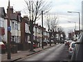
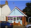
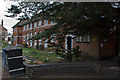
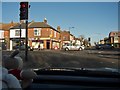
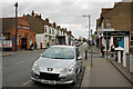
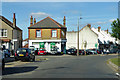
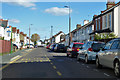
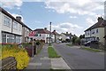
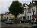
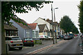
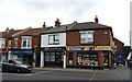
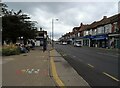
27 photos from this area
Area Information
Key information about the SS2 4LJ including its size, population, and administrative classification.
- Area Type
- Postcode
- Area Size
- 6809 m²
- Population
- 1644
- Population Density
- 2350 people/km²
House Prices in SS2 4LJ
28
Properties
£189,437
Average Sold Price
£59,995
Lowest Price
£335,000
Highest Price
Showing 28 properties
| Address | Type | Beds | Baths | Last Sale Price | Last Sale Date | |
|---|---|---|---|---|---|---|
| 102 Rylands Road, Southend On Sea, SS2 4LJ | house | - | - | £335,000 | Feb 2022 | |
| 130 Rylands Road, Southend On Sea, SS2 4LJ | Bungalow | 2 | 1 | £243,000 | Dec 2019 | |
| 110 Rylands Road, Southend On Sea, SS2 4LJ | Flat | - | - | £135,000 | Oct 2019 | |
| 128 Rylands Road, Southend On Sea, SS2 4LJ | Bungalow | 2 | 1 | £238,000 | Aug 2019 | |
| 100 Rylands Road, Southend On Sea, SS2 4LJ | Terraced | 3 | 1 | £247,000 | Jan 2019 | |
| 80 Rylands Road, Southend On Sea, SS2 4LJ | Bungalow | 2 | 1 | £300,000 | Oct 2017 | |
| 104 Rylands Road, Southend On Sea, SS2 4LJ | Bungalow | - | - | £254,000 | May 2017 | |
| 126 Rylands Road, Southend On Sea, SS2 4LJ | Terraced | - | - | £180,000 | Jul 2016 | |
| 92 Rylands Road, Southend On Sea, SS2 4LJ | Terraced | 3 | - | £200,000 | Jul 2015 | |
| 94 Rylands Road, Southend On Sea, SS2 4LJ | Terraced | 3 | - | £200,000 | May 2015 |
Page 1 of 3
Energy Efficiency in SS2 4LJ
Amenities
Schools
| Rank | School | Type | Entry gender | Ages |
|---|
Explore more schools in this area
Go to Schools tabDemographics
Household Size
One person
most common
Accommodation Type
Houses
most common
Tenure
45
majority
Ethnic Group
White
most common
Religion
N/A
most common
Household Composition
N/A
most common
Age
47
median
Adults (30-64 years)
most common
Household Deprivation
N/A
with no deprivation
NS-SEC
21
in Lower managerial occupations
Explore more demographic insights in this area
Go to Demographics tabPlanning
Planning Constraints
- Flood RiskPremium
- Ramsar Wetland SitesPremium
- Area of Outstanding Natural BeautyPremium
- Protected Nature ReservePremium
- Protected WoodlandPremium