Area Overview for SS2 4EW
Photos of SS2 4EW
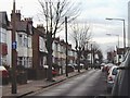
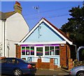

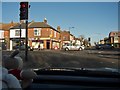
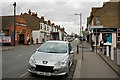
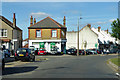
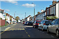
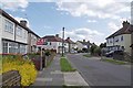
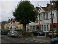
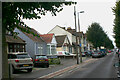
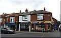
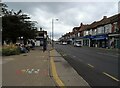
27 photos from this area
Area Information
Key information about the SS2 4EW including its size, population, and administrative classification.
- Area Type
- Postcode
- Area Size
- 1.7 hectares
- Population
- 1631
- Population Density
- 8499 people/km²
House Prices in SS2 4EW
72
Properties
£191,272
Average Sold Price
£48,000
Lowest Price
£340,000
Highest Price
Showing 72 properties
| Address | Type | Beds | Baths | Last Sale Price | Last Sale Date | |
|---|---|---|---|---|---|---|
| 27 Seaforth Grove, Southend On Sea, SS2 4EW | house | - | - | £260,000 | Nov 2021 | |
| 60 Seaforth Grove, Southend On Sea, SS2 4EW | house | - | - | £301,500 | Jul 2021 | |
| 49 Seaforth Grove, Southend On Sea, SS2 4EW | Detached | 4 | 2 | £340,000 | Jan 2021 | |
| 53 Seaforth Grove, Southend On Sea, SS2 4EW | Terraced | 3 | 1 | £237,000 | May 2020 | |
| 36 Seaforth Grove, Southend On Sea, SS2 4EW | Semi-detached | 3 | 2 | £340,000 | Nov 2019 | |
| 46 Seaforth Grove, Southend On Sea, SS2 4EW | Semi-detached | 3 | 1 | £310,000 | Sep 2019 | |
| 25 Seaforth Grove, Southend On Sea, SS2 4EW | Bungalow | 2 | 1 | £260,000 | Jun 2019 | |
| 65 Seaforth Grove, Southend On Sea, SS2 4EW | Flat | 2 | 1 | £185,000 | Feb 2019 | |
| 17 Seaforth Grove, Southend On Sea, SS2 4EW | Terraced | 4 | 2 | £288,000 | Jun 2018 | |
| 30 Seaforth Grove, Southend On Sea, SS2 4EW | Semi-detached | 1 | 1 | £247,500 | Sep 2017 |
Page 1 of 8
Energy Efficiency in SS2 4EW
Amenities
Schools
| Rank | School | Type | Entry gender | Ages |
|---|
Explore more schools in this area
Go to Schools tabDemographics
Household Size
Family (3-5 people)
most common
Accommodation Type
Houses
most common
Tenure
66
majority
Ethnic Group
White
most common
Religion
N/A
most common
Household Composition
N/A
most common
Age
47
median
Adults (30-64 years)
most common
Household Deprivation
N/A
with no deprivation
NS-SEC
29
in Lower managerial occupations
Explore more demographic insights in this area
Go to Demographics tabPlanning
Planning Constraints
- Flood RiskPremium
- Ramsar Wetland SitesPremium
- Area of Outstanding Natural BeautyPremium
- Protected Nature ReservePremium
- Protected WoodlandPremium