Area Overview for SS17 0BG
Photos of SS17 0BG
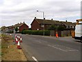


25 photos from this area
Area Information
Key information about the SS17 0BG including its size, population, and administrative classification.
- Area Type
- Postcode
- Area Size
- 7501 m²
- Population
- 1525
- Population Density
- 1703 people/km²
House Prices in SS17 0BG
14
Properties
£251,500
Average Sold Price
£140,000
Lowest Price
£400,000
Highest Price
Showing 14 properties
| Address | Type | Beds | Baths | Last Sale Price | Last Sale Date | |
|---|---|---|---|---|---|---|
| 171 Corringham Road, Stanford Le Hope, SS17 0BG | house | - | - | £400,000 | Sep 2021 | |
| 165 Corringham Road, Stanford Le Hope, SS17 0BG | house | - | - | £330,000 | Dec 2020 | |
| 153 Corringham Road, Stanford Le Hope, SS17 0BG | house | 3 | 2 | £340,000 | Dec 2020 | |
| 173 Corringham Road, Stanford Le Hope, SS17 0BG | house | - | - | £400,000 | Nov 2019 | |
| 159 Corringham Road, Stanford Le Hope, SS17 0BG | house | - | - | £167,000 | Jul 2013 | |
| 169 Corringham Road, Stanford Le Hope, SS17 0BG | house | - | - | £205,000 | Jan 2013 | |
| 175 Corringham Road, Stanford Le Hope, SS17 0BG | Semi-detached | - | - | £180,000 | Oct 2011 | |
| 167 Corringham Road, Stanford Le Hope, SS17 0BG | house | - | - | £173,000 | Jul 2010 | |
| 155 Corringham Road, Stanford Le Hope, SS17 0BG | Semi-detached | - | - | £180,000 | Jun 2006 | |
| 157 Corringham Road, Stanford Le Hope, SS17 0BG | Semi-detached | - | - | £140,000 | Sep 2002 |
Page 1 of 2
Energy Efficiency in SS17 0BG
Amenities
Schools
| Rank | School | Type | Entry gender | Ages |
|---|
Explore more schools in this area
Go to Schools tabDemographics
Household Size
Family (3-5 people)
most common
Accommodation Type
Houses
most common
Tenure
67
majority
Ethnic Group
White
most common
Religion
N/A
most common
Household Composition
N/A
most common
Age
47
median
Adults (30-64 years)
most common
Household Deprivation
N/A
with no deprivation
NS-SEC
25
in Lower managerial occupations
Explore more demographic insights in this area
Go to Demographics tabPlanning
Planning Constraints
- Flood RiskPremium
- Ramsar Wetland SitesPremium
- Area of Outstanding Natural BeautyPremium
- Protected Nature ReservePremium
- Protected WoodlandPremium