Area Overview for SS17 0AT
Photos of SS17 0AT
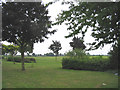
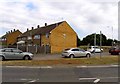
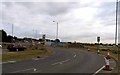
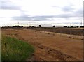
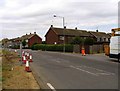

25 photos from this area
Area Information
Key information about the SS17 0AT including its size, population, and administrative classification.
- Area Type
- Postcode
- Area Size
- 1.6 hectares
- Population
- 1525
- Population Density
- 1703 people/km²
House Prices in SS17 0AT
40
Properties
£226,934
Average Sold Price
£59,500
Lowest Price
£425,000
Highest Price
Showing 40 properties
| Address | Type | Beds | Baths | Last Sale Price | Last Sale Date | |
|---|---|---|---|---|---|---|
| 16 Conrad Road, Stanford Le Hope, SS17 0AT | Retail | 3 | - | £425,000 | Sep 2022 | |
| 30 Conrad Road, Stanford Le Hope, SS17 0AT | house | - | - | £365,000 | Jan 2022 | |
| 22 Conrad Road, Stanford Le Hope, SS17 0AT | Semi-detached | 2 | 1 | £259,995 | Jan 2020 | |
| 32 Conrad Road, Stanford Le Hope, SS17 0AT | house | - | - | £336,000 | Nov 2019 | |
| 23 Conrad Road, Stanford Le Hope, SS17 0AT | Semi-detached | 4 | 2 | £340,000 | Jul 2019 | |
| 13 Conrad Road, Stanford Le Hope, SS17 0AT | Semi-detached | 3 | 2 | £293,000 | Jun 2017 | |
| 44 Conrad Road, Stanford Le Hope, SS17 0AT | house | - | - | £290,000 | Oct 2016 | |
| 27 Conrad Road, Stanford Le Hope, SS17 0AT | house | - | - | £320,000 | Jul 2016 | |
| 28 Conrad Road, Stanford Le Hope, SS17 0AT | Semi-detached | 3 | - | £200,000 | Aug 2015 | |
| 25 Conrad Road, Stanford Le Hope, SS17 0AT | house | - | - | £235,000 | Sep 2014 |
Page 1 of 4
Energy Efficiency in SS17 0AT
Amenities
Schools
| Rank | School | Type | Entry gender | Ages |
|---|
Explore more schools in this area
Go to Schools tabDemographics
Household Size
Family (3-5 people)
most common
Accommodation Type
Houses
most common
Tenure
67
majority
Ethnic Group
White
most common
Religion
N/A
most common
Household Composition
N/A
most common
Age
47
median
Adults (30-64 years)
most common
Household Deprivation
N/A
with no deprivation
NS-SEC
25
in Lower managerial occupations
Explore more demographic insights in this area
Go to Demographics tabPlanning
Planning Constraints
- Flood RiskPremium
- Ramsar Wetland SitesPremium
- Area of Outstanding Natural BeautyPremium
- Protected Nature ReservePremium
- Protected WoodlandPremium