Area Overview for SS14 3LT
Photos of SS14 3LT
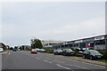
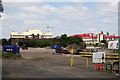
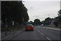
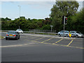
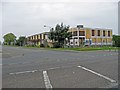
14 photos from this area
Area Information
Key information about the SS14 3LT including its size, population, and administrative classification.
- Area Type
- Postcode
- Area Size
- 1.2 hectares
- Population
- 2132
- Population Density
- 2646 people/km²
House Prices in SS14 3LT
31
Properties
£177,900
Average Sold Price
£45,000
Lowest Price
£385,000
Highest Price
Showing 31 properties
| Address | Type | Beds | Baths | Last Sale Price | Last Sale Date | |
|---|---|---|---|---|---|---|
| 47 Pendle Drive, Basildon, SS14 3LT | house | - | - | £385,000 | Oct 2022 | |
| 39 Pendle Drive, Basildon, SS14 3LT | Retail | 3 | 2 | £330,000 | Jan 2022 | |
| 41 Pendle Drive, Basildon, SS14 3LT | Terraced | 2 | 1 | £230,000 | Aug 2020 | |
| 53 Pendle Drive, Basildon, SS14 3LT | Terraced | 2 | 1 | £260,000 | Oct 2019 | |
| 18 Pendle Drive, Basildon, SS14 3LT | Terraced | 2 | - | £200,000 | Feb 2015 | |
| 49 Pendle Drive, Basildon, SS14 3LT | house | - | - | £182,500 | Jan 2015 | |
| 35 Pendle Drive, Basildon, SS14 3LT | house | - | - | £168,000 | Dec 2014 | |
| 23 Pendle Drive, Basildon, SS14 3LT | Flat | - | - | £93,000 | Mar 2014 | |
| 16 Pendle Drive, Basildon, SS14 3LT | Terraced | 2 | - | £148,500 | Jul 2013 | |
| 28 Pendle Drive, Basildon, SS14 3LT | Terraced | 3 | - | £132,500 | Mar 2013 |
Page 1 of 4
Energy Efficiency in SS14 3LT
Amenities
Schools
| Rank | School | Type | Entry gender | Ages |
|---|
Explore more schools in this area
Go to Schools tabDemographics
Household Size
Family (3-5 people)
most common
Accommodation Type
Houses
most common
Tenure
67
majority
Ethnic Group
White
most common
Religion
N/A
most common
Household Composition
N/A
most common
Age
47
median
Adults (30-64 years)
most common
Household Deprivation
N/A
with no deprivation
NS-SEC
25
in Lower managerial occupations
Explore more demographic insights in this area
Go to Demographics tabPlanning
Planning Constraints
- Flood RiskPremium
- Ramsar Wetland SitesPremium
- Area of Outstanding Natural BeautyPremium
- Protected Nature ReservePremium
- Protected WoodlandPremium