Area Overview for SS14 3LN
Photos of SS14 3LN

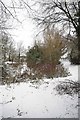
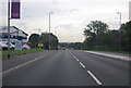
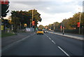
14 photos from this area
Area Information
Key information about the SS14 3LN including its size, population, and administrative classification.
- Area Type
- Postcode
- Area Size
- 2.6 hectares
- Population
- 2132
- Population Density
- 2646 people/km²
House Prices in SS14 3LN
50
Properties
£233,413
Average Sold Price
£32,400
Lowest Price
£437,500
Highest Price
Showing 50 properties
| Address | Type | Beds | Baths | Last Sale Price | Last Sale Date | |
|---|---|---|---|---|---|---|
| 17 Theydon Crescent, Basildon, SS14 3LN | Terraced | 3 | 1 | £335,000 | Nov 2025 | |
| 65 Theydon Crescent, Basildon, SS14 3LN | Terraced | 3 | 2 | £437,500 | Jun 2025 | |
| 34 Theydon Crescent, Basildon, SS14 3LN | Terraced | 2 | 1 | £315,500 | Mar 2025 | |
| 30 Theydon Crescent, Basildon, SS14 3LN | Terraced | 2 | 1 | £330,000 | Jan 2025 | |
| 26 Theydon Crescent, Basildon, SS14 3LN | Terraced | 2 | 1 | £310,000 | Aug 2024 | |
| 23 Theydon Crescent, Basildon, SS14 3LN | house | - | - | £350,000 | Dec 2022 | |
| 33 Theydon Crescent, Basildon, SS14 3LN | house | - | - | £408,000 | Mar 2022 | |
| 1 Theydon Crescent, Basildon, SS14 3LN | house | - | - | £260,000 | Jul 2021 | |
| 52 Theydon Crescent, Basildon, SS14 3LN | house | - | - | £345,000 | Jun 2021 | |
| 7 Theydon Crescent, Basildon, SS14 3LN | house | - | - | £238,000 | Jan 2021 |
Page 1 of 5
Energy Efficiency in SS14 3LN
Amenities
Schools
| Rank | School | Type | Entry gender | Ages |
|---|
Explore more schools in this area
Go to Schools tabDemographics
Household Size
Family (3-5 people)
most common
Accommodation Type
Houses
most common
Tenure
67
majority
Ethnic Group
White
most common
Religion
N/A
most common
Household Composition
N/A
most common
Age
47
median
Adults (30-64 years)
most common
Household Deprivation
N/A
with no deprivation
NS-SEC
25
in Lower managerial occupations
Explore more demographic insights in this area
Go to Demographics tabPlanning
Planning Constraints
- Flood RiskPremium
- Ramsar Wetland SitesPremium
- Area of Outstanding Natural BeautyPremium
- Protected Nature ReservePremium
- Protected WoodlandPremium