Area Overview for SS11 8NJ
Photos of SS11 8NJ
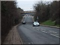
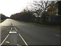
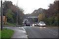
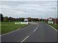
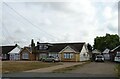
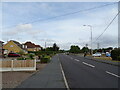
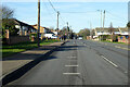
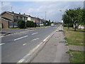
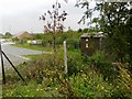
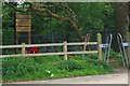
13 photos from this area
Area Information
Key information about the SS11 8NJ including its size, population, and administrative classification.
- Area Type
- Postcode
- Area Size
- 2.3 hectares
- Population
- 1496
- Population Density
- 2923 people/km²
House Prices in SS11 8NJ
49
Properties
£242,651
Average Sold Price
£59,500
Lowest Price
£485,000
Highest Price
Showing 49 properties
| Address | Type | Beds | Baths | Last Sale Price | Last Sale Date | |
|---|---|---|---|---|---|---|
| 140 Beauchamps Drive, Wickford, SS11 8NJ | Bungalow | 3 | 1 | £485,000 | May 2023 | |
| 146 Beauchamps Drive, Wickford, SS11 8NJ | Semi-detached | 3 | 1 | £425,000 | Apr 2023 | |
| 108 Beauchamps Drive, Wickford, SS11 8NJ | Semi-detached | 2 | 1 | £335,000 | Sep 2021 | |
| 118 Beauchamps Drive, Wickford, SS11 8NJ | Bungalow | - | - | £350,000 | Apr 2021 | |
| 114 Beauchamps Drive, Wickford, SS11 8NJ | Bungalow | 3 | 1 | £338,000 | Mar 2021 | |
| 170 Beauchamps Drive, Wickford, SS11 8NJ | Detached | 5 | 2 | £410,000 | Dec 2019 | |
| 122 Beauchamps Drive, Wickford, SS11 8NJ | Bungalow | - | - | £280,000 | May 2019 | |
| 106 Beauchamps Drive, Wickford, SS11 8NJ | Semi-detached | 2 | 1 | £297,500 | Aug 2018 | |
| 130 Beauchamps Drive, Wickford, SS11 8NJ | Bungalow | - | - | £277,500 | May 2018 | |
| 100 Beauchamps Drive, Wickford, SS11 8NJ | Semi-detached | 2 | 1 | £300,000 | May 2018 |
Page 1 of 5
Energy Efficiency in SS11 8NJ
Amenities
Schools
| Rank | School | Type | Entry gender | Ages |
|---|
Explore more schools in this area
Go to Schools tabDemographics
Household Size
Two person
most common
Accommodation Type
Houses
most common
Tenure
88
majority
Ethnic Group
White
most common
Religion
N/A
most common
Household Composition
N/A
most common
Age
47
median
Adults (30-64 years)
most common
Household Deprivation
N/A
with no deprivation
NS-SEC
32
in Lower managerial occupations
Explore more demographic insights in this area
Go to Demographics tabPlanning
Planning Constraints
- Flood RiskPremium
- Ramsar Wetland SitesPremium
- Area of Outstanding Natural BeautyPremium
- Protected Nature ReservePremium
- Protected WoodlandPremium