Area Overview for SS11 8NH
Photos of SS11 8NH


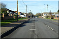
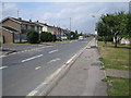
13 photos from this area
Area Information
Key information about the SS11 8NH including its size, population, and administrative classification.
- Area Type
- Postcode
- Area Size
- 5862 m²
- Population
- 1496
- Population Density
- 2923 people/km²
House Prices in SS11 8NH
17
Properties
£295,571
Average Sold Price
£71,000
Lowest Price
£487,000
Highest Price
Showing 17 properties
| Address | Type | Beds | Baths | Last Sale Price | Last Sale Date | |
|---|---|---|---|---|---|---|
| 119 Beauchamps Drive, Wickford, SS11 8NH | Detached | 3 | 2 | £487,000 | Jul 2025 | |
| 115 Beauchamps Drive, Wickford, SS11 8NH | Semi-detached | 4 | 2 | £430,000 | Mar 2025 | |
| 137 Beauchamps Drive, Wickford, SS11 8NH | house | - | - | £360,000 | Nov 2022 | |
| 127 Beauchamps Drive, Wickford, SS11 8NH | Retail | 3 | 1 | £365,000 | Jul 2022 | |
| 139 Beauchamps Drive, Wickford, SS11 8NH | Semi-detached | 3 | - | £320,000 | Sep 2019 | |
| 123 Beauchamps Drive, Wickford, SS11 8NH | Semi-detached | 3 | - | £335,000 | Mar 2019 | |
| 129 Beauchamps Drive, Wickford, SS11 8NH | house | - | - | £343,500 | Nov 2018 | |
| 125 Beauchamps Drive, Wickford, SS11 8NH | house | - | - | £322,000 | Sep 2018 | |
| 113 Beauchamps Drive, Wickford, SS11 8NH | house | 3 | - | £314,995 | Apr 2015 | |
| 121 Beauchamps Drive, Wickford, SS11 8NH | Semi-detached | 3 | - | £200,000 | Jan 2014 |
Page 1 of 2
Energy Efficiency in SS11 8NH
Amenities
Schools
| Rank | School | Type | Entry gender | Ages |
|---|
Explore more schools in this area
Go to Schools tabDemographics
Household Size
Two person
most common
Accommodation Type
Houses
most common
Tenure
88
majority
Ethnic Group
White
most common
Religion
N/A
most common
Household Composition
N/A
most common
Age
47
median
Adults (30-64 years)
most common
Household Deprivation
N/A
with no deprivation
NS-SEC
32
in Lower managerial occupations
Explore more demographic insights in this area
Go to Demographics tabPlanning
Planning Constraints
- Flood RiskPremium
- Ramsar Wetland SitesPremium
- Area of Outstanding Natural BeautyPremium
- Protected Nature ReservePremium
- Protected WoodlandPremium