Area Overview for SS1 2LL
Photos of SS1 2LL
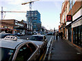
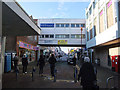
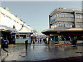
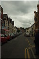
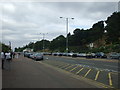
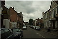
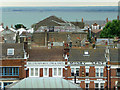
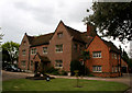

100 photos from this area
Area Information
Key information about the SS1 2LL including its size, population, and administrative classification.
- Area Type
- Postcode
- Area Size
- 9112 m²
- Population
- 2570
- Population Density
- 8224 people/km²
House Prices in SS1 2LL
31
Properties
£134,454
Average Sold Price
£17,000
Lowest Price
£300,000
Highest Price
Showing 31 properties
| Address | Type | Beds | Baths | Last Sale Price | Last Sale Date | |
|---|---|---|---|---|---|---|
| 34 Grange Gardens, Southend On Sea, SS1 2LL | Flat | 1 | 1 | £106,000 | Jun 2023 | |
| 7A Grange Gardens, Southend On Sea, SS1 2LL | Flat | - | - | £160,000 | Oct 2022 | |
| Escot, Grange Gardens, Southend On Sea, SS1 2LL | Flat | 3 | 1 | £275,000 | Sep 2022 | |
| 30 Grange Gardens, Southend On Sea, SS1 2LL | Retail | 3 | 1 | £300,000 | May 2022 | |
| 20A Grange Gardens, Southend On Sea, SS1 2LL | Flat | - | - | £195,000 | Dec 2021 | |
| 28A Grange Gardens, Southend On Sea, SS1 2LL | Maisonette | - | - | £165,000 | Mar 2021 | |
| 18A Grange Gardens, Southend On Sea, SS1 2LL | Flat | - | - | £140,000 | Feb 2021 | |
| 22A Grange Gardens, Southend On Sea, SS1 2LL | Flat | - | - | £220,000 | Mar 2020 | |
| 36A Grange Gardens, Southend On Sea, SS1 2LL | Flat | - | - | £64,926 | Aug 2019 | |
| 36 Grange Gardens, Southend On Sea, SS1 2LL | Flat | - | - | £64,926 | Aug 2019 |
Page 1 of 4
Energy Efficiency in SS1 2LL
Amenities
Schools
| Rank | School | Type | Entry gender | Ages |
|---|
Explore more schools in this area
Go to Schools tabDemographics
Household Size
One person
most common
Accommodation Type
Flats
most common
Tenure
31
majority
Ethnic Group
White
most common
Religion
N/A
most common
Household Composition
N/A
most common
Age
47
median
Adults (30-64 years)
most common
Household Deprivation
N/A
with no deprivation
NS-SEC
22
in Lower managerial occupations
Explore more demographic insights in this area
Go to Demographics tabPlanning
Planning Constraints
- Flood RiskPremium
- Ramsar Wetland SitesPremium
- Area of Outstanding Natural BeautyPremium
- Protected Nature ReservePremium
- Protected WoodlandPremium