Area Overview for SS1 2JJ
Photos of SS1 2JJ
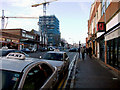
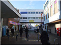
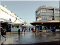
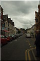
100 photos from this area
Area Information
Key information about the SS1 2JJ including its size, population, and administrative classification.
- Area Type
- Postcode
- Area Size
- 1.5 hectares
- Population
- 2113
- Population Density
- 4907 people/km²
House Prices in SS1 2JJ
29
Properties
£187,677
Average Sold Price
£49,450
Lowest Price
£310,000
Highest Price
Showing 29 properties
| Address | Type | Beds | Baths | Last Sale Price | Last Sale Date | |
|---|---|---|---|---|---|---|
| 69 Warrior Square, Southend On Sea, SS1 2JJ | Terraced | 5 | 1 | £300,000 | Jul 2022 | |
| 49 Warrior Square East, Southend On Sea, SS1 2JJ | Terraced | 4 | 2 | £275,000 | Jul 2018 | |
| 71 Warrior Square, Southend On Sea, SS1 2JJ | Terraced | 5 | - | £245,000 | Apr 2014 | |
| 73 Warrior Square, Southend On Sea, SS1 2JJ | Flat | - | - | £144,000 | Jul 2010 | |
| 63 Warrior Square East, Southend On Sea, SS1 2JJ | Terraced | - | - | £310,000 | May 2008 | |
| 57 Warrior Square East, Southend On Sea, SS1 2JJ | Terraced | 7 | 2 | £245,000 | Oct 2007 | |
| 67A Warrior Square, Southend On Sea, SS1 2JJ | Flat | 2 | 1 | £117,000 | Jan 2007 | |
| 51 Warrior Square East, Southend On Sea, SS1 2JJ | Flat | - | - | £109,000 | Oct 2006 | |
| 67 Warrior Square, Southend On Sea, SS1 2JJ | Flat | - | - | £95,000 | Jan 2003 | |
| 65 Warrior Square, Southend On Sea, SS1 2JJ | Flat | - | - | £175,000 | Nov 2002 |
Page 1 of 3
Energy Efficiency in SS1 2JJ
Amenities
Schools
| Rank | School | Type | Entry gender | Ages |
|---|
Explore more schools in this area
Go to Schools tabDemographics
Household Size
One person
most common
Accommodation Type
Flats
most common
Tenure
28
majority
Ethnic Group
White
most common
Religion
N/A
most common
Household Composition
N/A
most common
Age
47
median
Adults (30-64 years)
most common
Household Deprivation
N/A
with no deprivation
NS-SEC
26
in Lower managerial occupations
Explore more demographic insights in this area
Go to Demographics tabPlanning
Planning Constraints
- Flood RiskPremium
- Ramsar Wetland SitesPremium
- Area of Outstanding Natural BeautyPremium
- Protected Nature ReservePremium
- Protected WoodlandPremium