Area Overview for SS0 8PT
Photos of SS0 8PT
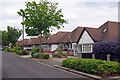
89 photos from this area
Area Information
Key information about the SS0 8PT including its size, population, and administrative classification.
- Area Type
- Postcode
- Area Size
- 1.5 hectares
- Population
- 1557
- Population Density
- 4534 people/km²
House Prices in SS0 8PT
27
Properties
£643,727
Average Sold Price
£170,000
Lowest Price
£1,000,000
Highest Price
Showing 27 properties
| Address | Type | Beds | Baths | Last Sale Price | Last Sale Date | |
|---|---|---|---|---|---|---|
| 62 Mount Avenue, Westcliff On Sea, SS0 8PT | house | - | - | £880,000 | Aug 2022 | |
| 28 Mount Avenue, Westcliff On Sea, SS0 8PT | Detached | 4 | - | £1,000,000 | Aug 2022 | |
| 52 Mount Avenue, Westcliff On Sea, SS0 8PT | house | 4 | - | £855,000 | Jul 2022 | |
| 44 Mount Avenue, Westcliff On Sea, SS0 8PT | house | 4 | - | £880,000 | May 2021 | |
| 64 Mount Avenue, Westcliff On Sea, SS0 8PT | Bungalow | 2 | 1 | £595,000 | Nov 2020 | |
| 36 Mount Avenue, Westcliff On Sea, SS0 8PT | Detached | 4 | 2 | £925,000 | Oct 2019 | |
| 16 Mount Avenue, Westcliff On Sea, SS0 8PT | Detached | 4 | 2 | £810,000 | Feb 2019 | |
| 54 Mount Avenue, Westcliff On Sea, SS0 8PT | Semi-detached | 4 | 2 | £705,000 | Nov 2018 | |
| 22 Mount Avenue, Westcliff On Sea, SS0 8PT | house | - | - | £850,000 | Nov 2018 | |
| 46 Mount Avenue, Westcliff On Sea, SS0 8PT | Detached | 4 | 2 | £880,000 | Jan 2018 |
Page 1 of 3
Energy Efficiency in SS0 8PT
Amenities
Schools
| Rank | School | Type | Entry gender | Ages |
|---|
Explore more schools in this area
Go to Schools tabDemographics
Household Size
Family (3-5 people)
most common
Accommodation Type
Houses
most common
Tenure
83
majority
Ethnic Group
White
most common
Religion
N/A
most common
Household Composition
N/A
most common
Age
47
median
Adults (30-64 years)
most common
Household Deprivation
N/A
with no deprivation
NS-SEC
54
in Lower managerial occupations
Explore more demographic insights in this area
Go to Demographics tabPlanning
Planning Constraints
- Flood RiskPremium
- Ramsar Wetland SitesPremium
- Area of Outstanding Natural BeautyPremium
- Protected Nature ReservePremium
- Protected WoodlandPremium