Area Overview for SS0 8PR
Photos of SS0 8PR
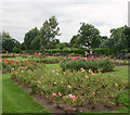
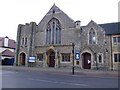
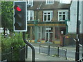
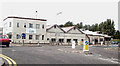
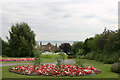
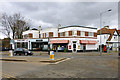
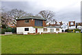
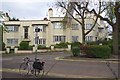
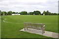
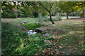
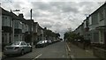
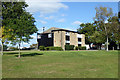
40 photos from this area
Area Information
Key information about the SS0 8PR including its size, population, and administrative classification.
- Area Type
- Postcode
- Area Size
- 1.4 hectares
- Population
- 1557
- Population Density
- 4534 people/km²
House Prices in SS0 8PR
33
Properties
£511,750
Average Sold Price
£93,500
Lowest Price
£1,435,000
Highest Price
Showing 33 properties
| Address | Type | Beds | Baths | Last Sale Price | Last Sale Date | |
|---|---|---|---|---|---|---|
| 9 Parkside, Westcliff On Sea, SS0 8PR | Detached | 5 | 4 | £1,435,000 | Dec 2024 | |
| 15 Parkside, Westcliff On Sea, SS0 8PR | house | 4 | 2 | £1,000,000 | Feb 2024 | |
| 28 Parkside, Westcliff On Sea, SS0 8PR | house | - | - | £1,100,000 | Oct 2022 | |
| 33 Parkside, Westcliff On Sea, SS0 8PR | Bungalow | 4 | 2 | £815,000 | Jun 2020 | |
| 3 Parkside, Westcliff On Sea, SS0 8PR | house | - | - | £637,000 | Oct 2015 | |
| 39 Parkside, Westcliff On Sea, SS0 8PR | house | - | - | £630,000 | Dec 2011 | |
| 20 Parkside, Westcliff On Sea, SS0 8PR | house | - | - | £290,000 | Jan 2010 | |
| 27 Parkside, Westcliff On Sea, SS0 8PR | house | 4 | - | £440,000 | Dec 2009 | |
| 22 Parkside, Westcliff On Sea, SS0 8PR | Detached | - | - | £335,000 | Sep 2007 | |
| 17 Parkside, Westcliff On Sea, SS0 8PR | Flat | - | - | £160,000 | Nov 2004 |
Page 1 of 4
Energy Efficiency in SS0 8PR
Amenities
Schools
| Rank | School | Type | Entry gender | Ages |
|---|
Explore more schools in this area
Go to Schools tabDemographics
Household Size
Family (3-5 people)
most common
Accommodation Type
Houses
most common
Tenure
83
majority
Ethnic Group
White
most common
Religion
N/A
most common
Household Composition
N/A
most common
Age
47
median
Adults (30-64 years)
most common
Household Deprivation
N/A
with no deprivation
NS-SEC
54
in Lower managerial occupations
Explore more demographic insights in this area
Go to Demographics tabPlanning
Planning Constraints
- Flood RiskPremium
- Ramsar Wetland SitesPremium
- Area of Outstanding Natural BeautyPremium
- Protected Nature ReservePremium
- Protected WoodlandPremium